-
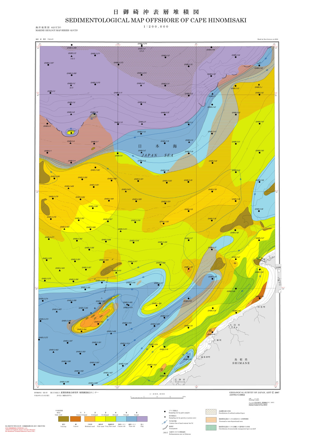
日御碕沖表層堆積図 1:200,000 (2007)
地質調査総合センター名称: 日御碕沖表層堆積図 1:200,000 / Sedimentological Map Offshore of Cape Hinomisaki and Explanatory Notes 1:200,000 著者: 池原 研 / IKEHARA Ken 発行年: 2007 シリーズ: 海洋地質図 / Marine Geology Map... -
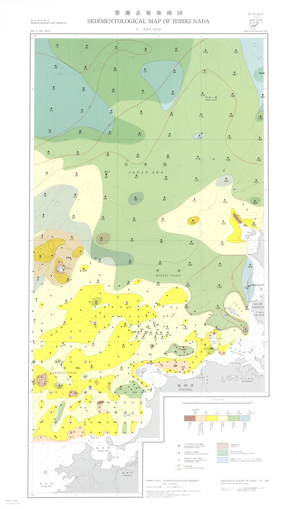
響灘表層堆積図 1:200,000 (2001)
地質調査総合センター名称: 響灘表層堆積図 1:200,000 / Sedimentological Map of Hibiki-Nada and Explanatory Notes 1:200,000 著者: 池原 研 / IKEHARA Ken 発行年: 2001 シリーズ: 海洋地質図 / Marine Geology Map Series 発行者: 地質調査所 /... -
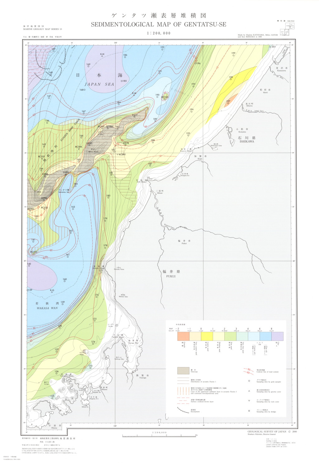
ゲンタツ瀬表層堆積図 1:200,000 (2000)
地質調査総合センター名称: ゲンタツ瀬表層堆積図 1:200,000 / Sedimentological Map of Gentatsu-se and Explanatory Notes 1:200,000 著者: 片山 肇, 佐藤 幹夫, 池原 研 / KATAYAMA Hajime, SATOH Mikio, IKEHARA Ken 発行年: 2000 シリーズ:... -
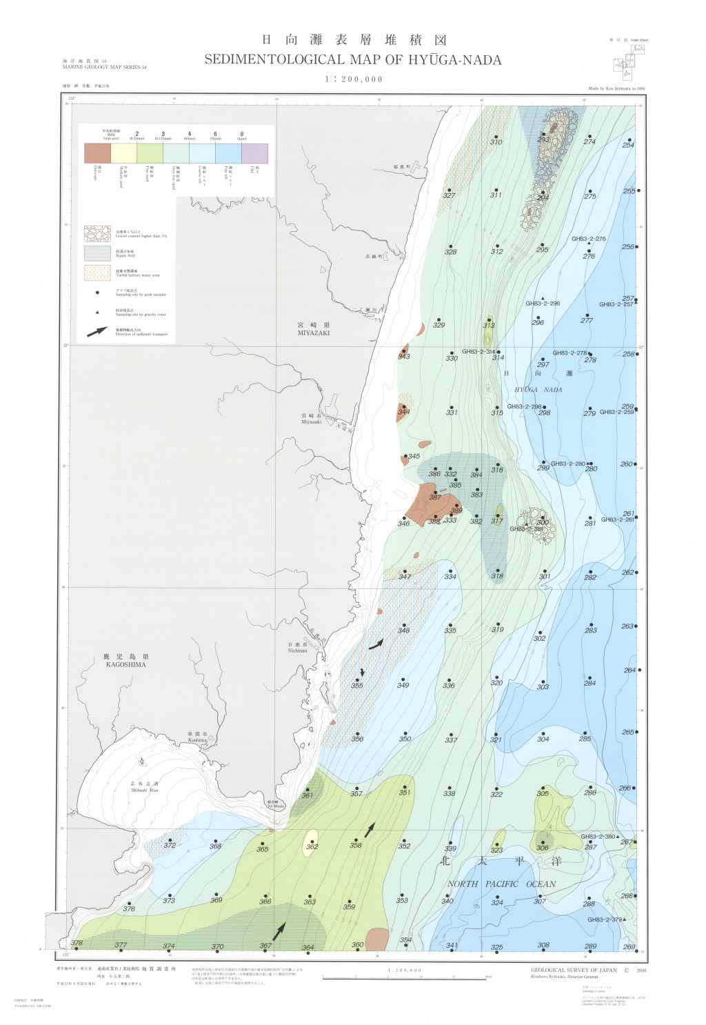
日向灘表層堆積図 1:200,000 (2000)
地質調査総合センター名称: 日向灘表層堆積図 1:200,000 / Sedimentological Map of Hyuga-Nada and Explanatory Notes 1:200,000 著者: 池原 研 / IKEHARA Ken 発行年: 2000 シリーズ: 海洋地質図 / Marine Geology Map Series 発行者: 地質調査所 /... -
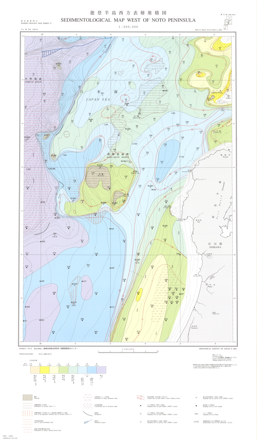
能登半島西方表層堆積図 1:200,000 (2001)
地質調査総合センター名称: 能登半島西方表層堆積図 1:200,000 / Sedimentological Map West of Noto Peninsula and Explanatory Notes 1:200,000 著者: 片山 肇, 池原 研 / KATAYAMA Hajime, IKEHARA Ken 発行年: 2001 シリーズ: 海洋地質図 /... -
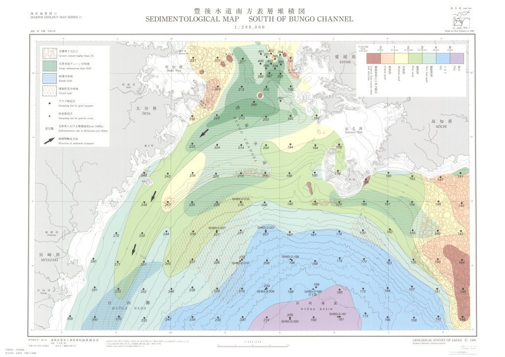
豊後水道南方表層堆積図 1:200,000 (1999)
地質調査総合センター名称: 豊後水道南方表層堆積図 1:200,000 / Sedimentological Map South of Bungo Channel and Explanatory Notes 1:200,000 著者: 池原 研 / IKEHARA Ken 発行年: 1999 シリーズ: 海洋地質図 / Marine Geology Map Series... -
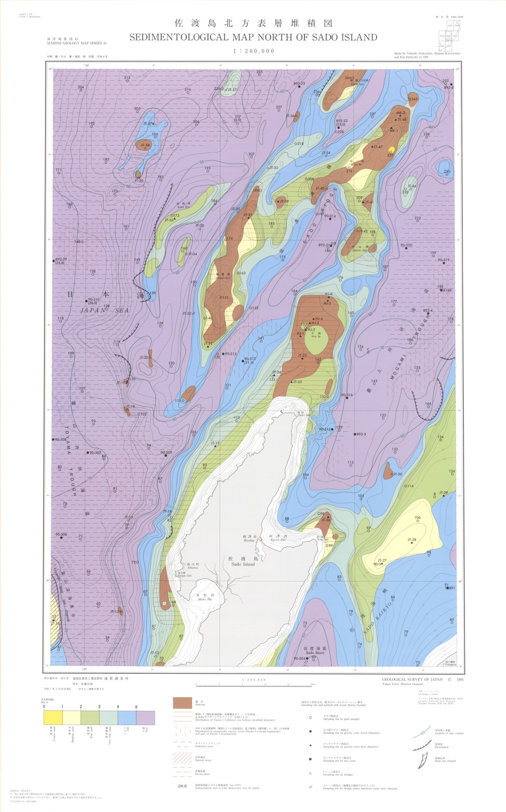
佐渡島北方表層堆積図 1:200,000 (1995)
地質調査総合センター名称: 佐渡島北方表層堆積図 1:200,000 / Sedimentological Map North of Sado Island and Explanatory Notes 1:200,000 著者: 中嶋 健, 片山 肇, 池原 研 / NAKAJIMA Takeshi, KATAYAMA Hajime, IKEHARA Ken 発行年:... -
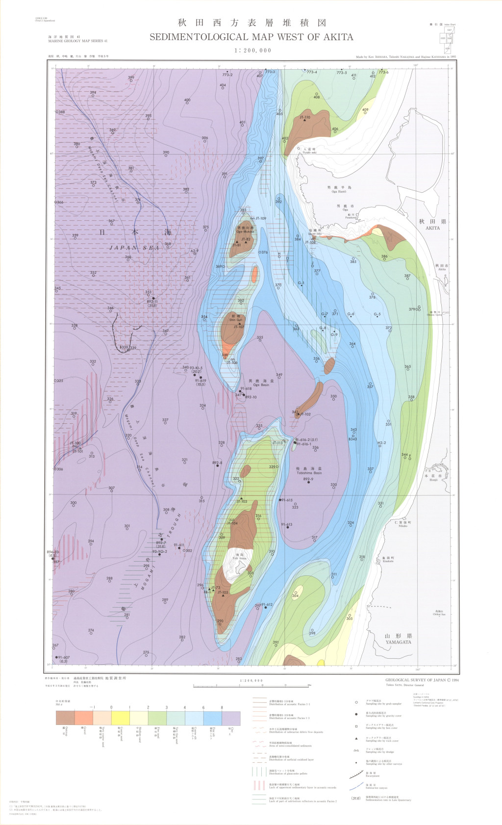
秋田西方表層堆積図 1:200,000 (1994)
地質調査総合センター名称: 秋田西方表層堆積図 1:200,000 / Sedimentological Map West of Akita and Explanatory Notes 1:200,000 著者: 池原 研, 中嶋 健, 片山 肇 / IKEHARA Ken, NAKAJIMA Takeshi, KATAYAMA Hajime 発行年: 1994... -
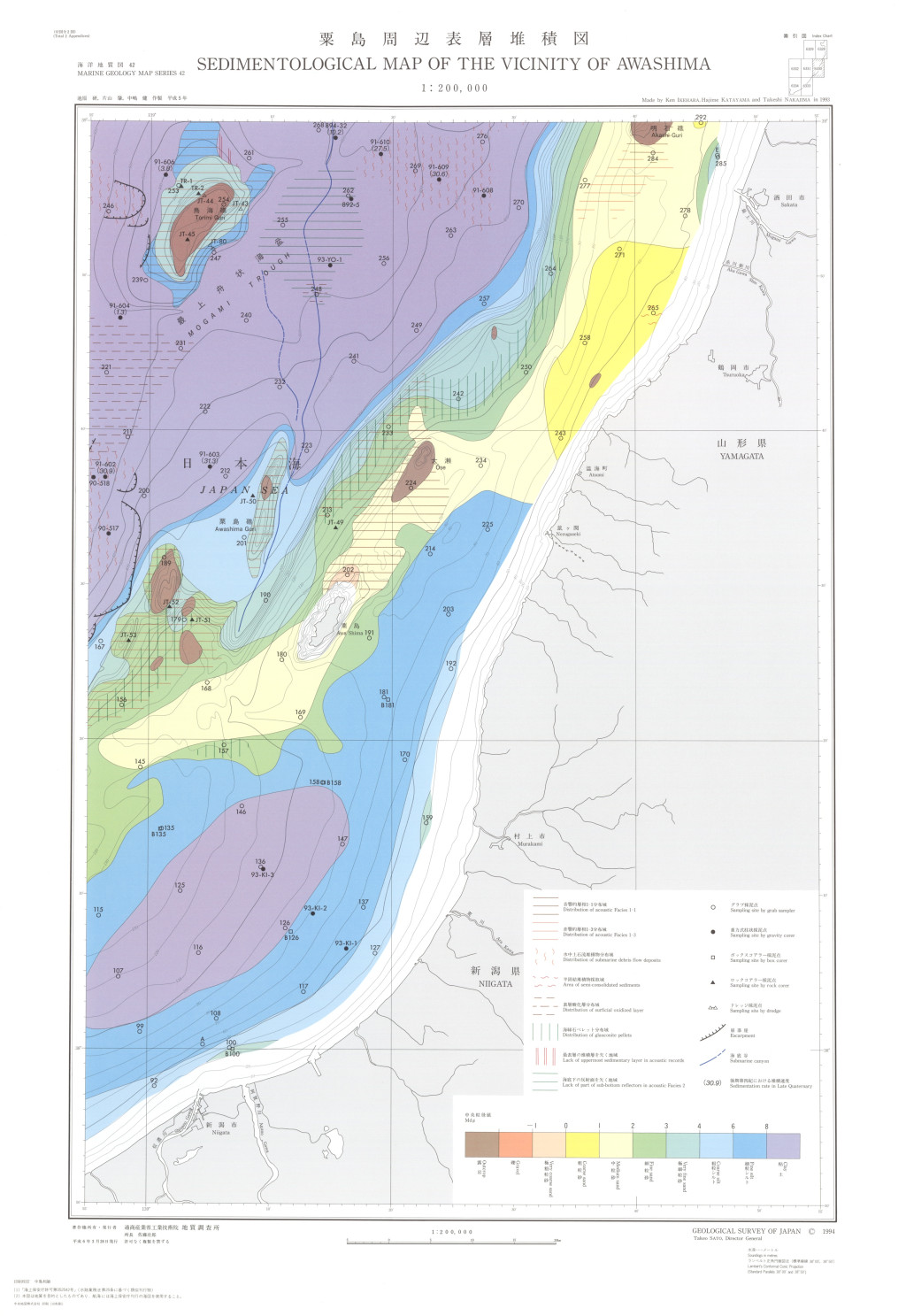
粟島周辺表層堆積図 1:200,000 (1994)
地質調査総合センター名称: 粟島周辺表層堆積図 1:200,000 / Sedimentological Map of the Vicinity of Awashima and Explanatory Notes 1:200,000 著者: 池原 研, 片山 肇, 中嶋 健 / IKEHARA Ken, KATAYAMA Hajime, NAKAJIMA Takeshi... -
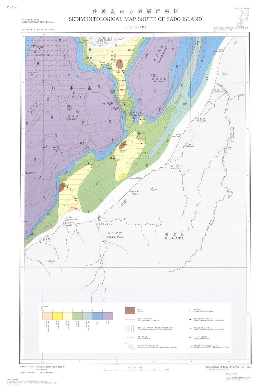
佐渡島南方表層堆積図 1:200,000 (1994)
地質調査総合センター名称: 佐渡島南方表層堆積図 1:200,000 / Sedimentological Map South of Sado Island and Explanatory Notes 1:200,000 著者: 片山 肇, 中嶋 健, 池原 研 / KATAYAMA Hajime, NAKAJIMA Takeshi, IKEHARA Ken 発行年:... -
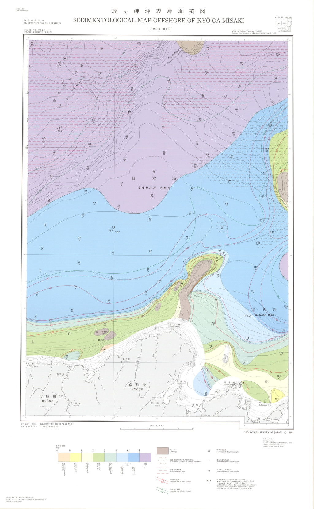
経ヶ岬沖表層堆積図 1:200,000 (1993)
地質調査総合センター名称: 経ヶ岬沖表層堆積図 1:200,000 / Sedimentological Map Offshore of Kyo-ga Misaki and Explanatory Notes 1:200,000 著者: 片山 肇, 佐藤 幹夫, 池原 研 / KATAYAMA Hajime, SATOH Mikio, IKEHARA Ken 発行年:... -
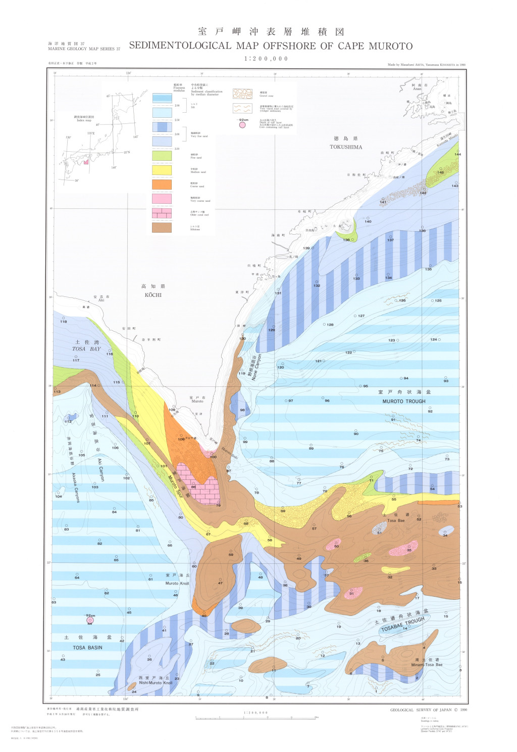
室戸岬沖表層堆積図 1:200,000 (1990)
地質調査総合センター名称: 室戸岬沖表層堆積図 1:200,000 / Sedimentological Map Offshore of Cape Muroto and Explanatory Notes 1:200,000 著者: 有田 正史, 木下 泰正 / ARITA Masafumi, KINOSHITA Yasumasa 発行年: 1990 シリーズ:... -
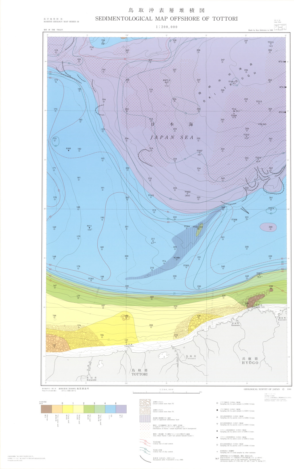
鳥取沖表層堆積図 1:200,000 (1990)
地質調査総合センター名称: 鳥取沖表層堆積図 1:200,000 / Sedimentological Map Offshore of Tottori and Explanatory Notes 1:200,000 著者: 池原 研, 片山 肇, 佐藤 幹夫 / IKEHARA Ken, KATAYAMA Hajime, SATOH Mikio 発行年: 1990... -
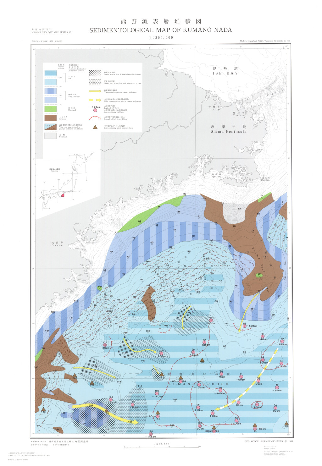
熊野灘表層堆積図 1:200,000 (1988)
地質調査総合センター名称: 熊野灘表層堆積図 1:200,000 / Sedimentary Map of Kumano Nada and Explanatory Notes 1:200,000 著者: 有田 正史, 木下 泰正 / ARITA Masafumi, KINOSHITA Yasumasa 発行年: 1988 シリーズ: 海洋地質図 / Marine... -
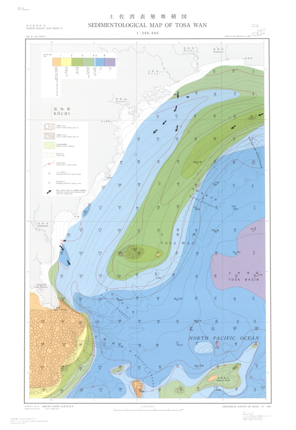
土佐湾表層堆積図 1:200,000 (1988)
地質調査総合センター名称: 土佐湾表層堆積図 1:200,000 / Sedimentological Map of Tosa Wan and Explanatory Notes 1:200,000 著者: 池原 研 / IKEHARA Ken 発行年: 1988 シリーズ: 海洋地質図 / Marine Geology Map Series 発行者: 地質調査所 /... -
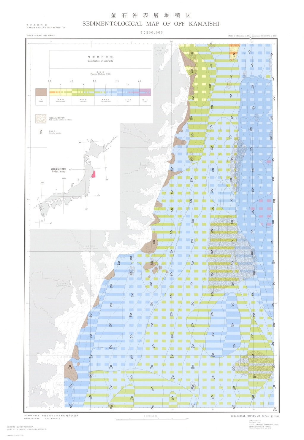
釜石沖表層堆積図 1:200,000 (1984)
地質調査総合センター名称: 釜石沖表層堆積図 1:200,000 / Sedimentological Map of Off Kamaishi 著者: 有田 正史, 木下 泰正 / ARITA Masafumi, KINOSHITA Yasumasa 発行年: 1984 シリーズ: 海洋地質図 / Marine Geology Map Series 発行者: 地質調査所... -
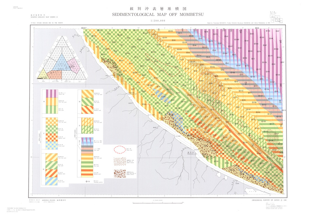
紋別沖表層堆積図 1:200,000 (1981)
地質調査総合センター名称: 紋別沖表層堆積図 1:200,000 / Sedimentological Map off Mombetsu 1:200,000 著者: 木下 泰正, 井内 美郎, 西村 清和, 西村 昭 / KINOSHITA Yasumasa, INOUCHI Yoshio, NISHIMURA Kiyokazu, NISHIMURA Akira 発行年:... -
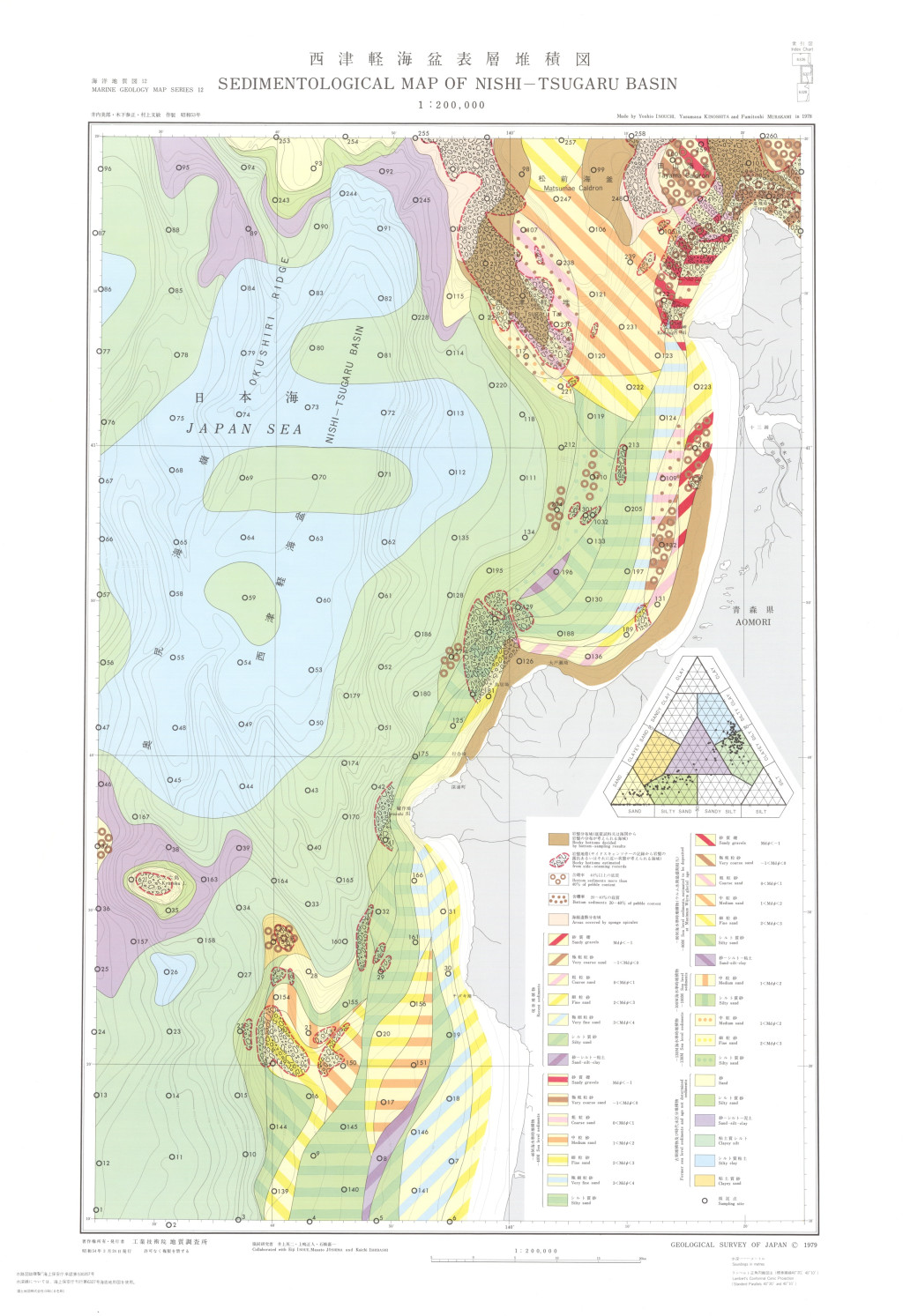
西津軽海盆表層堆積図 1:200,000 (1979)
地質調査総合センター名称: 西津軽海盆表層堆積図 1:200,000 / Sedimentological Map of Nishi-Tsugaru Basin 1:200,000 著者: 井内 美郎, 木下 泰正, 村上 文敏 / INOUCHI Yoshio, KINOSHITA Yasumasa, MURAKAMI Fumitoshi 発行年: 1979 シリーズ:... -
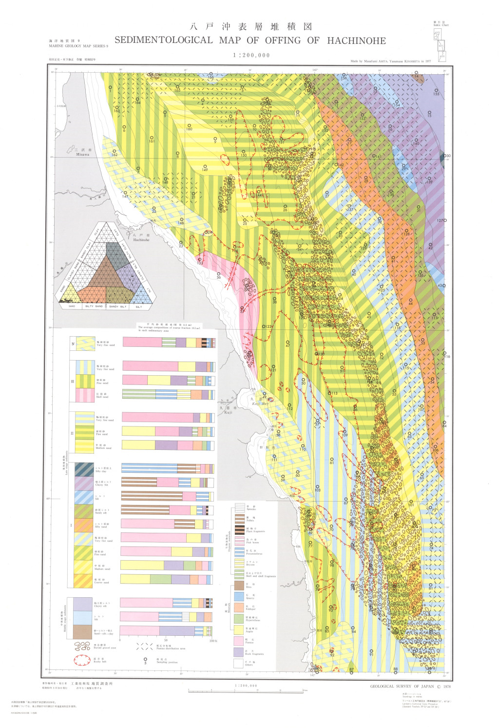
八戸沖表層堆積図 1:200,000 (1978)
地質調査総合センター名称: 八戸沖表層堆積図 1:200,000 / Sedimentological Map of Offing of Hachinohe 1:200,000 著者: 有田 正史, 木下 泰正 / ARITA Masafumi, KINOSHITA Yasumasa 発行年: 1978 シリーズ: 海洋地質図 / Marine Geology Map... -
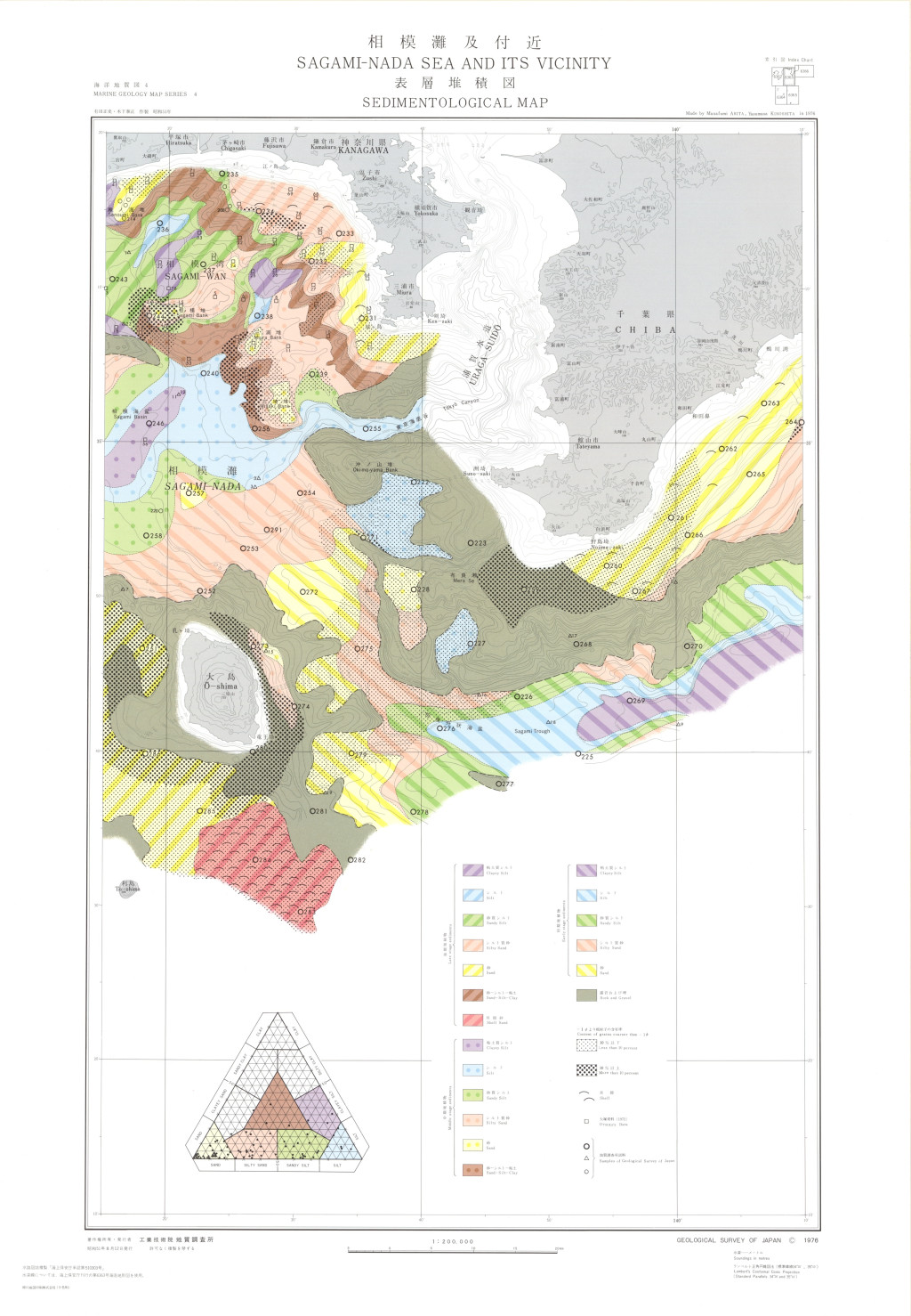
相模灘及付近表層堆積図 1:200,000 (1976)
地質調査総合センター名称: 相模灘及付近表層堆積図 1:200,000 / Sedimentological Map of Sagami-Nada Sea and Its Vicinity 1:200,000 著者: 有田 正史, 木下 泰正 / ARITA Masafumi, KINOSHITA Yasumasa 発行年: 1976 シリーズ: 海洋地質図 /...
