
You're currently viewing an old version of this dataset. To see the current version, click here.
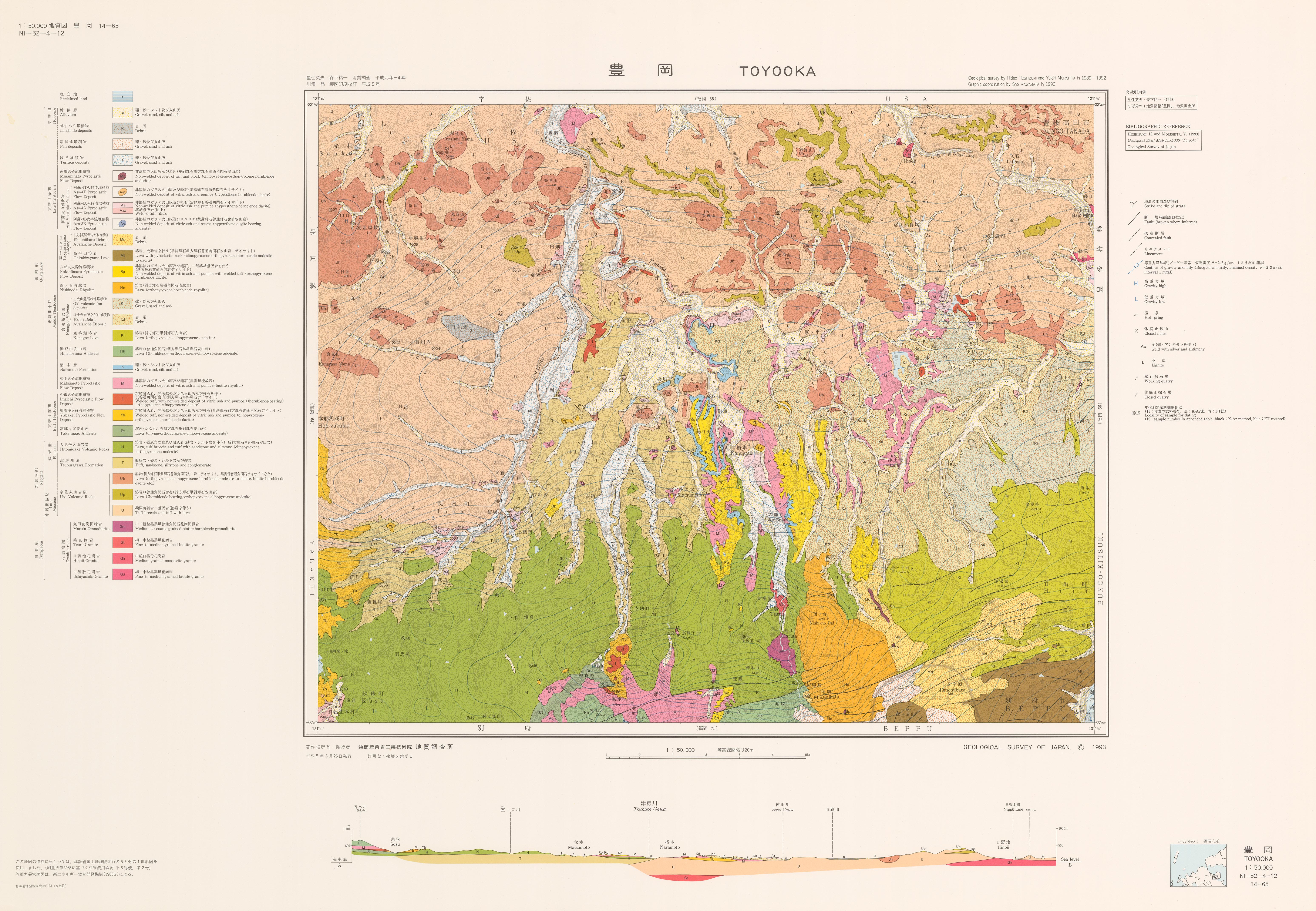
豊岡地域の地質: 原図
URL: https://www.gsj.jp/data/50KGM/JPG/GSJ_MAP_G050_14065_1993_200dpi.jpg
原図: ファイルサイズは 4.18 MB です。
Additional Information
| Field | Value |
|---|---|
| Resource id | 922a45ad-9183-48ce-9aee-45bd86cd3b3a |
| Last updated | December 5, 2023, 12:11 (+0900) |
| Created | December 5, 2023, 12:11 (+0900) |
| Format | JPEG |
| License | 政府標準利用規約 (第2.0版) |