
You're currently viewing an old version of this dataset. To see the current version, click here.
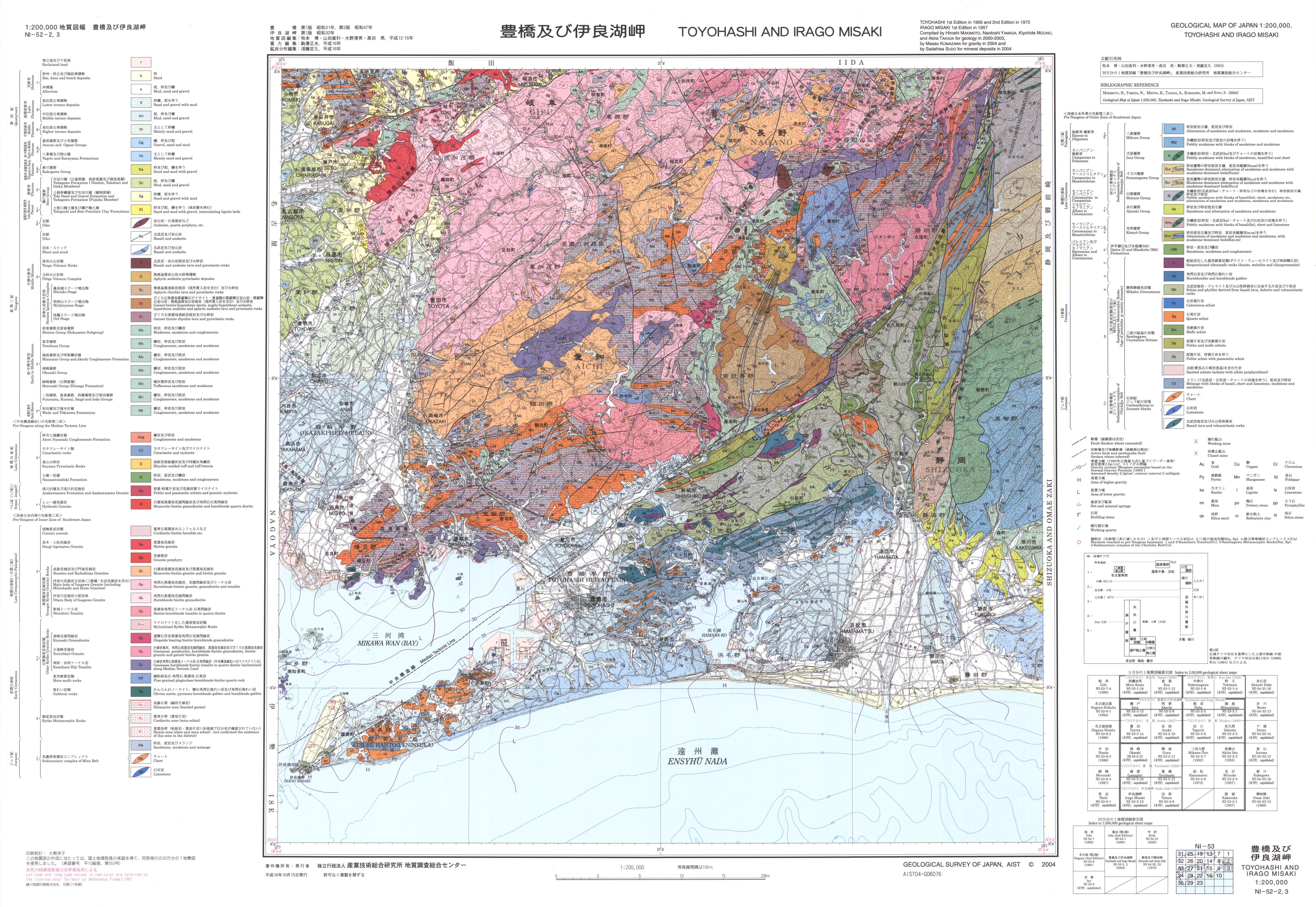
20万分の1地質図幅「豊橋及び伊良湖岬」: ラスターデータ
URL: https://www.gsj.jp/data/200KGM/JPG/GSJ_MAP_G200_NI5302_2004_200dpi.jpg
ラスターデータ: ファイルサイズは 4.51 MB です。
Additional Information
| Field | Value |
|---|---|
| Resource id | 7d24d862-fcf7-433a-a8cb-ede407fb3774 |
| Last updated | December 12, 2023, 17:45 (+0900) |
| Created | December 12, 2023, 17:45 (+0900) |
| Format | image/jpeg |
| License | 政府標準利用規約 (第2.0版) |