
You're currently viewing an old version of this dataset. To see the current version, click here.
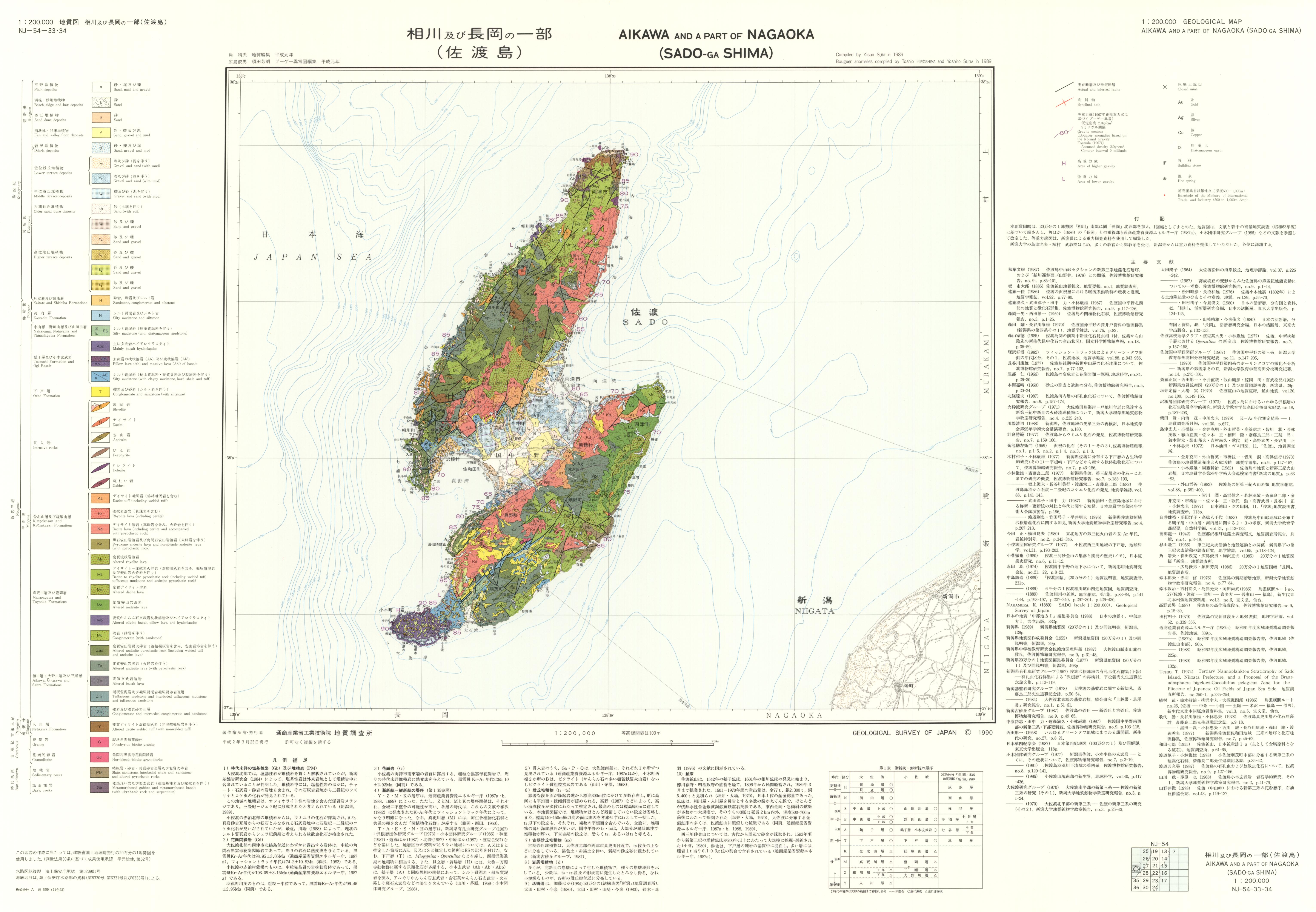
20万分の1地質図幅「相川及び長岡の一部」(佐渡島): ラスターデータ
URL: https://www.gsj.jp/data/200KGM/JPG/GSJ_MAP_G200_NJ5433_1990_200dpi.jpg
ラスターデータ: ファイルサイズは 2.58 MB です。
Additional Information
| Field | Value |
|---|---|
| Resource id | dd013be2-aea9-4ad2-a593-4adff6a24bfa |
| Last updated | December 13, 2023, 16:22 (+0900) |
| Created | December 13, 2023, 16:22 (+0900) |
| Format | image/jpeg |
| License | 政府標準利用規約 (第2.0版) |