
You're currently viewing an old version of this dataset. To see the current version, click here.
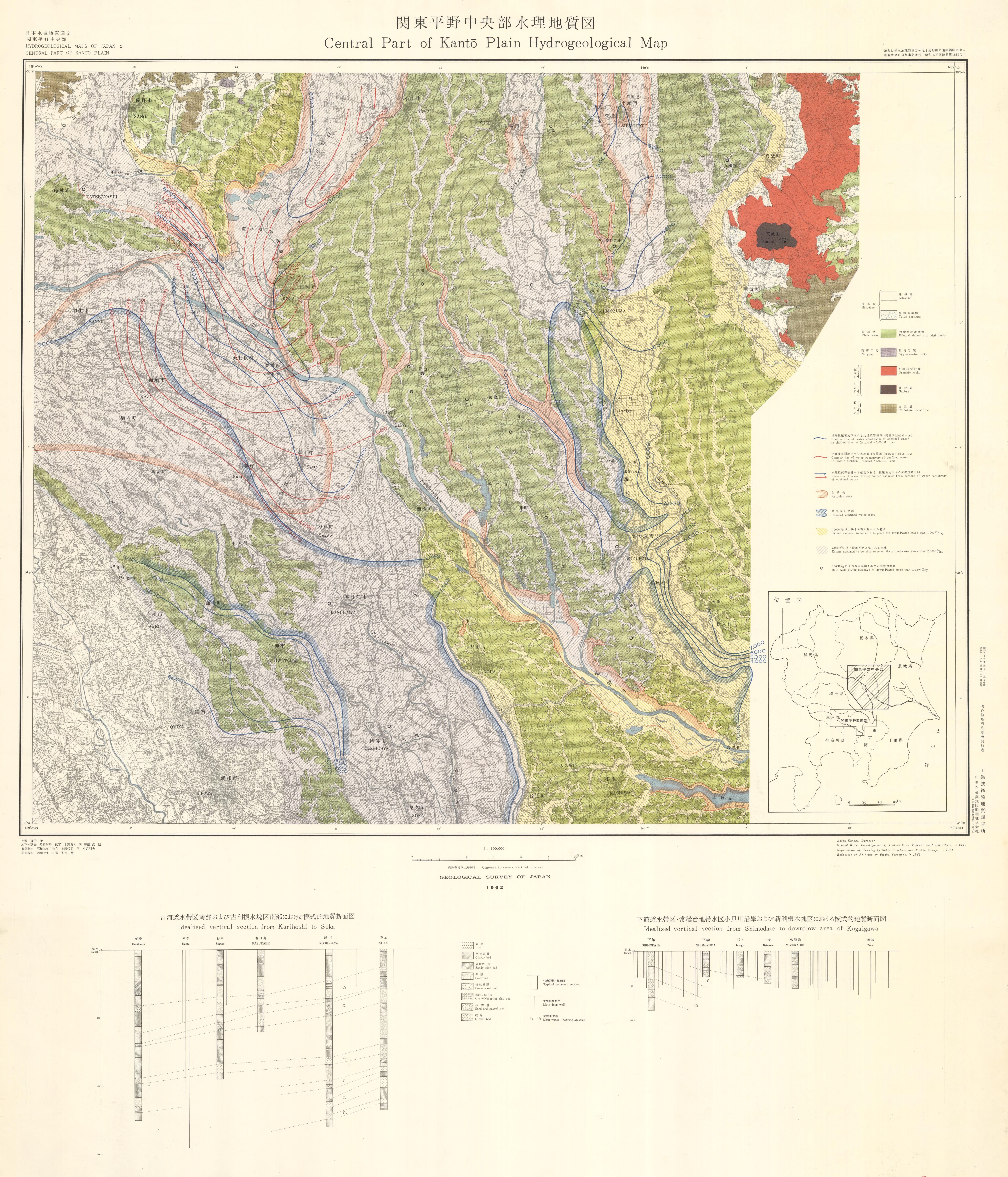
関東平野中央部水理地質図,1:100,000: ラスターデータ
URL: https://www.gsj.jp/data/HYDR/JPG/GSJ_MAP_HYDR_002_1962_200.jpg
ラスターデータ: ファイルサイズは 6.09 MB です。
Additional Information
| Field | Value |
|---|---|
| Resource id | f9d5aa36-686d-42af-9506-bd08f160056d |
| Last updated | December 13, 2023, 11:39 (+0900) |
| Created | December 13, 2023, 11:39 (+0900) |
| Format | image/jpeg |
| License | 政府標準利用規約 (第2.0版) |