Map display list
Map display list is empty.
日本語
/
English
Toggle navigation
GSJ
Data Catalog
Dataset
Organizations
Groups
Map
Home
/
Datasets
Submit
Order by
Relevance
Name Ascending
Name Descending
Last Modified
Popular
Go
1 dataset found
Groups:
海洋地質図(海底地質図)
Formats:
PDF
Filter Results
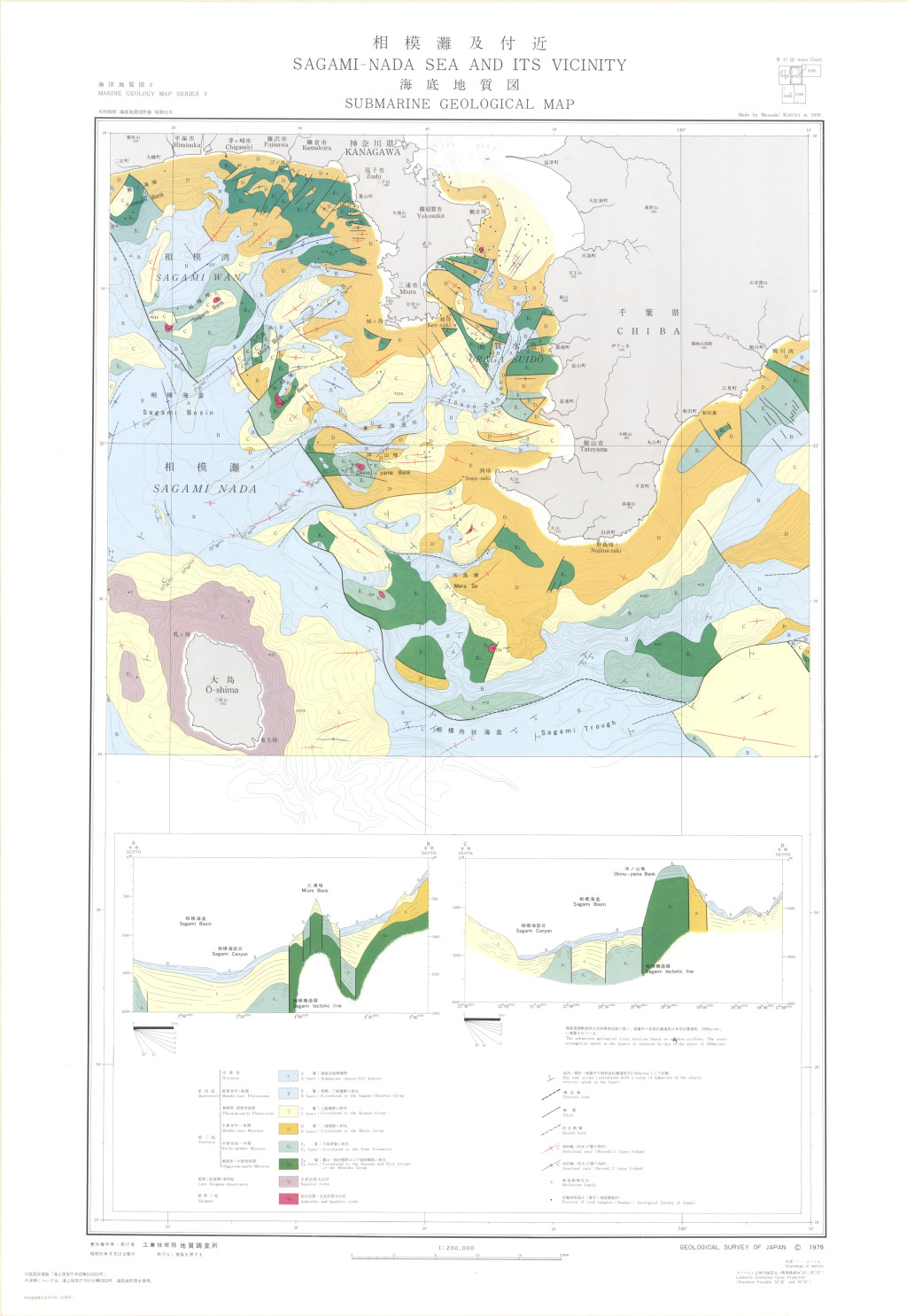
相模灘及付近海底地質図 1:200,000 (1976)
地質調査総合センター
名称: 相模灘及付近海底地質図 1:200,000 / Submarine Geological Map of Sagami-Nada Sea and Its Vicinity and Explanatory Notes 1:200,000 著者: 木村 政昭, 村上 文敏, 石原 丈実 / KIMURA Masaaki, MURAKAMI...
JSON
XYZ
PDF
JPEG
You can also access this registry using the
API
(see
API Docs
).