Map display list
Map display list is empty.
日本語
/
English
Toggle navigation
GSJ
Data Catalog
Dataset
Organizations
Groups
Map
Home
/
Datasets
Submit
Order by
Relevance
Name Ascending
Name Descending
Last Modified
Popular
Go
41 datasets found
Groups:
日本水理地質図
Formats:
JSON
Filter Results
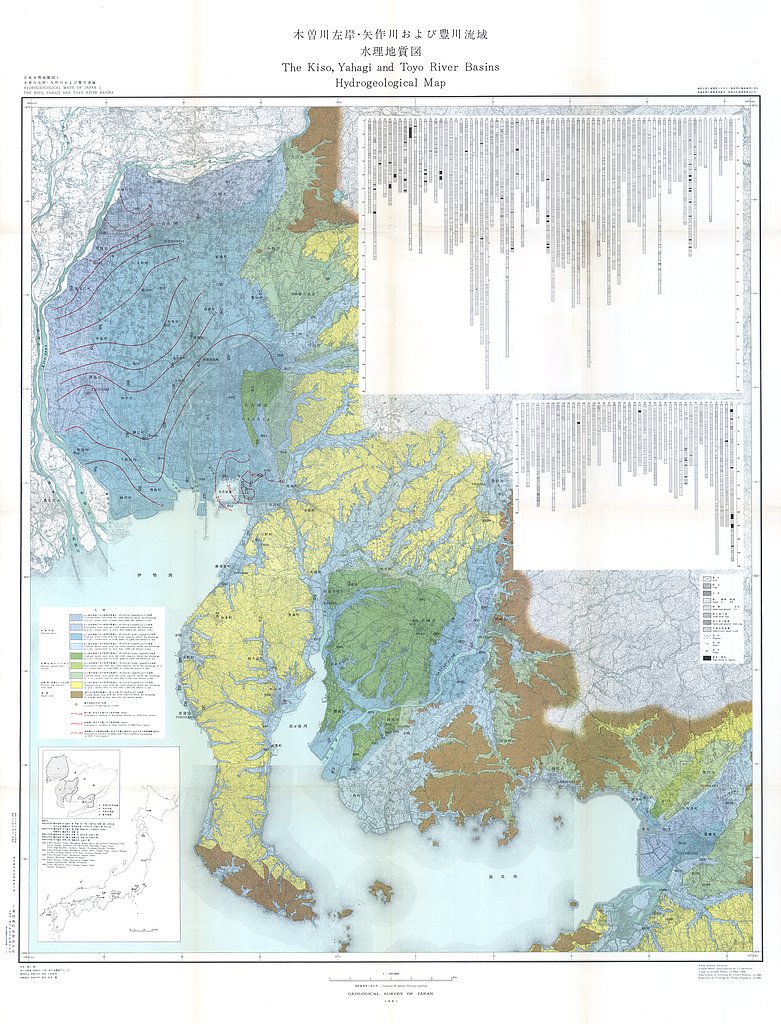
木曽川左岸・矢作川および豊川流域水理地質図,1:100,000 (1961)
地質調査総合センター
名称: 木曽川左岸・矢作川および豊川流域水理地質図,1:100,000 / Hydrogeological Map and Explanatory Text of the Kiso, Yahagi and Toyo River Basins, 1:100,000 著者: 村下 敏夫, 武居 由之 / MURASHITA Toshio, TAKEI...
JSON
XYZ
PDF
JPEG
«
1
2
3
You can also access this registry using the
API
(see
API Docs
).