
You're currently viewing an old version of this dataset. To see the current version, click here.
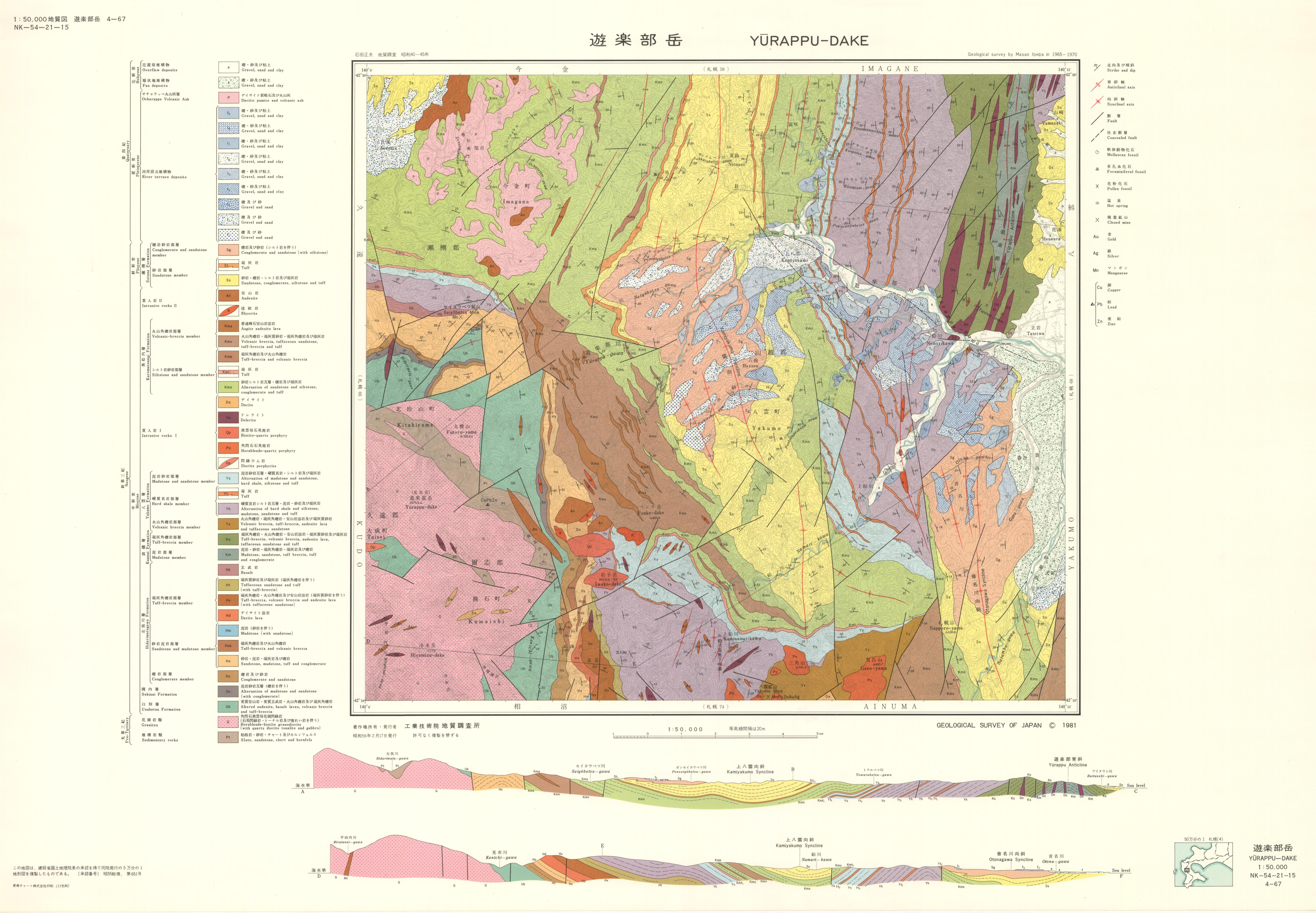
遊楽部岳地域の地質: 原図
URL: https://www.gsj.jp/data/50KGM/JPG/GSJ_MAP_G050_04067_1981_200dpi.jpg
原図: ファイルサイズは 3.28 MB です。
Additional Information
| Field | Value |
|---|---|
| Resource id | b4bc8ce1-d158-48aa-9718-43d7f52a74dc |
| Last updated | December 5, 2023, 12:12 (+0900) |
| Created | December 5, 2023, 12:12 (+0900) |
| Format | JPEG |
| License | 政府標準利用規約 (第2.0版) |