
You're currently viewing an old version of this dataset. To see the current version, click here.
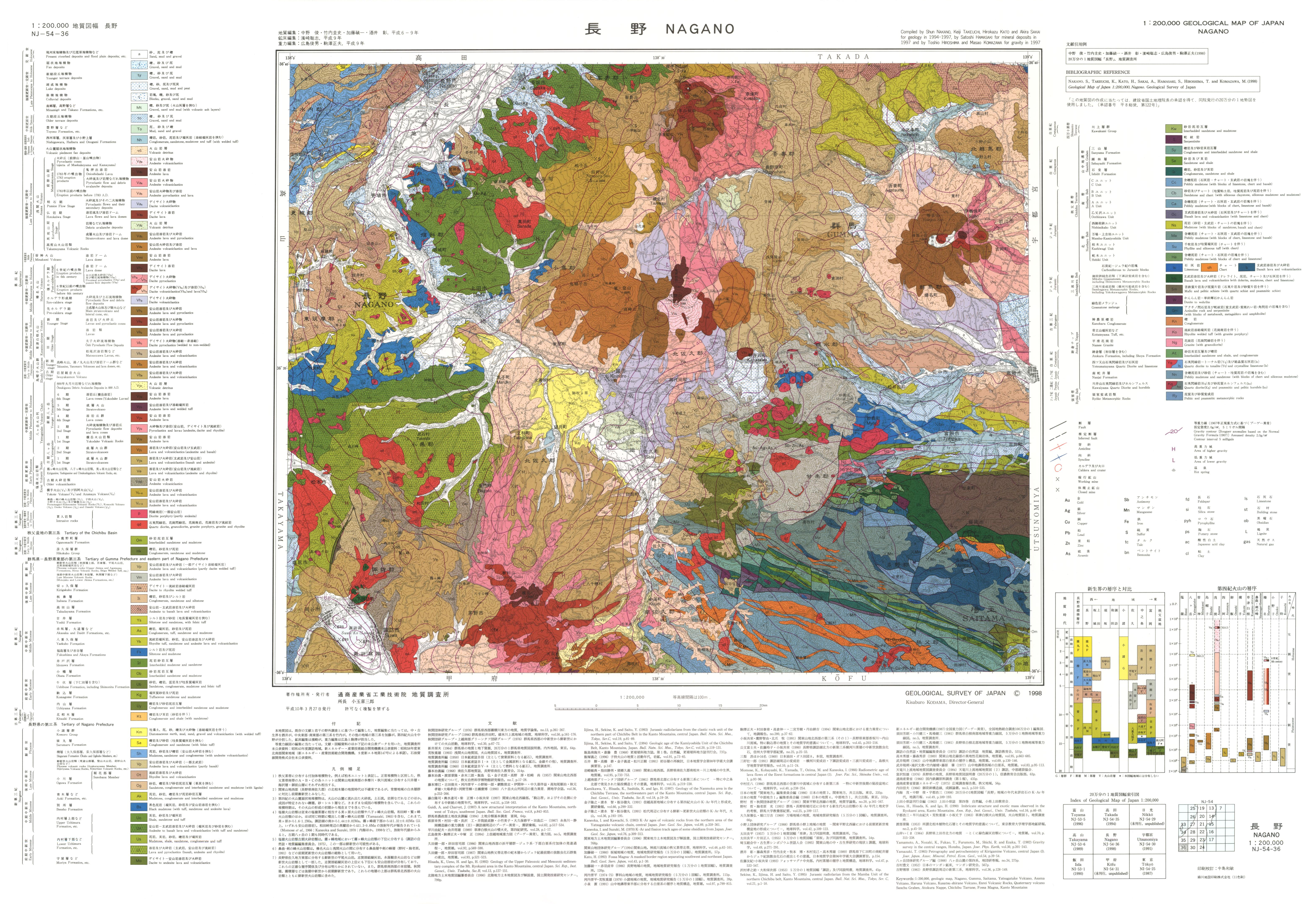
20万分の1地質図幅「長野」: 原図
URL: https://www.gsj.jp/data/200KGM/JPG/GSJ_MAP_G200_NJ5436_1998_200dpi.jpg
原図: ファイルサイズは 4.2 MB です。
Additional Information
| Field | Value |
|---|---|
| Resource id | 23005b66-48e3-40aa-91d4-dab1b65ff0cd |
| Last updated | December 5, 2023, 12:08 (+0900) |
| Created | December 5, 2023, 12:08 (+0900) |
| Format | JPEG |
| License | 政府標準利用規約 (第2.0版) |