
You're currently viewing an old version of this dataset. To see the current version, click here.
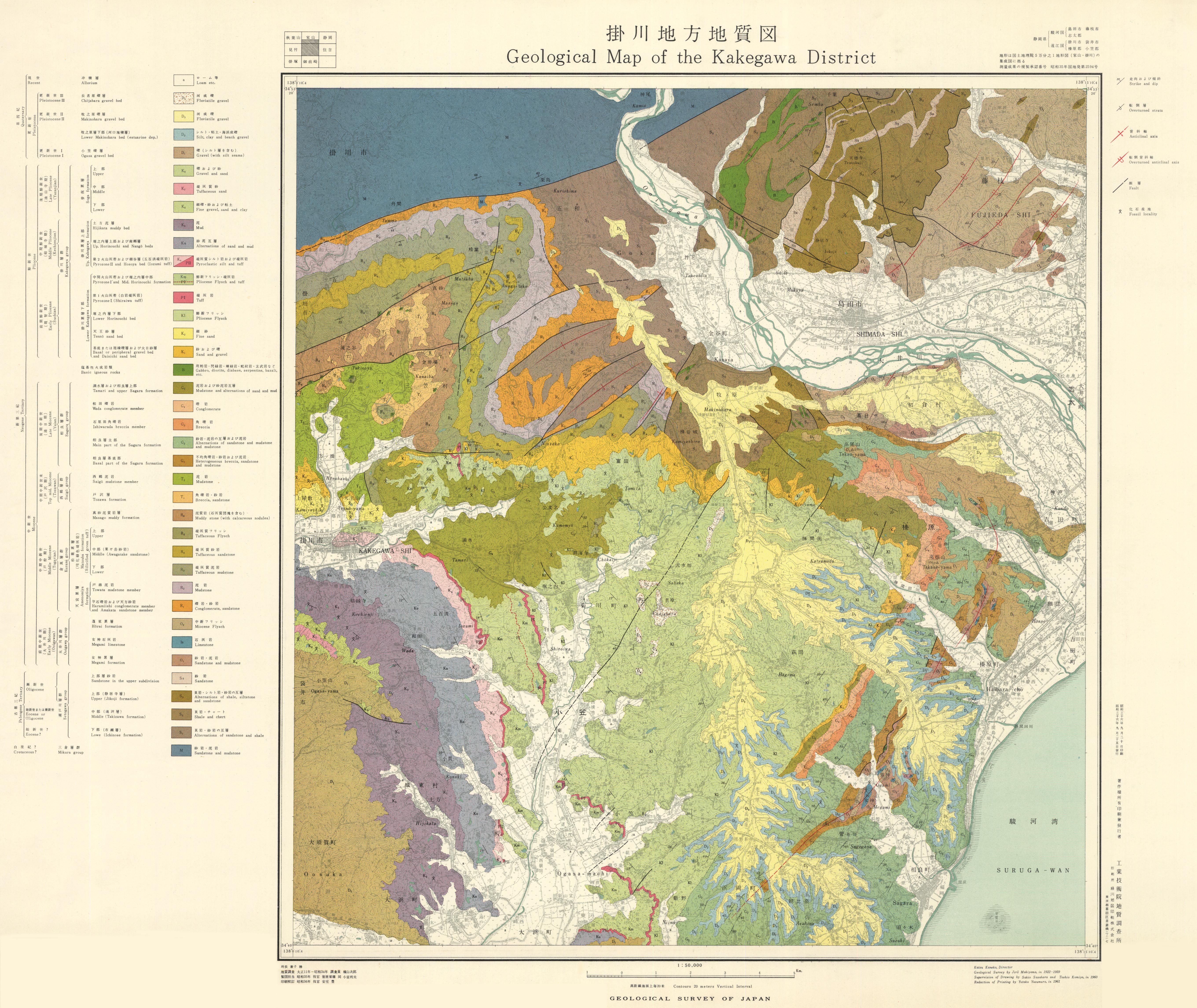
掛川地方地質図,1:50,000および説明書: 原図
URL: https://www.gsj.jp/data/MISC/JPG/GSJ_MAP_MISC_010_1961_200.jpg
原図: ファイルサイズは 3.7 MB です。
Additional Information
| Field | Value |
|---|---|
| Resource id | 1657e7ca-4424-4198-b793-c40d108cd654 |
| Last updated | December 5, 2023, 11:57 (+0900) |
| Created | December 5, 2023, 11:57 (+0900) |
| Format | JPEG |
| License | 政府標準利用規約 (第2.0版) |