
You're currently viewing an old version of this dataset. To see the current version, click here.
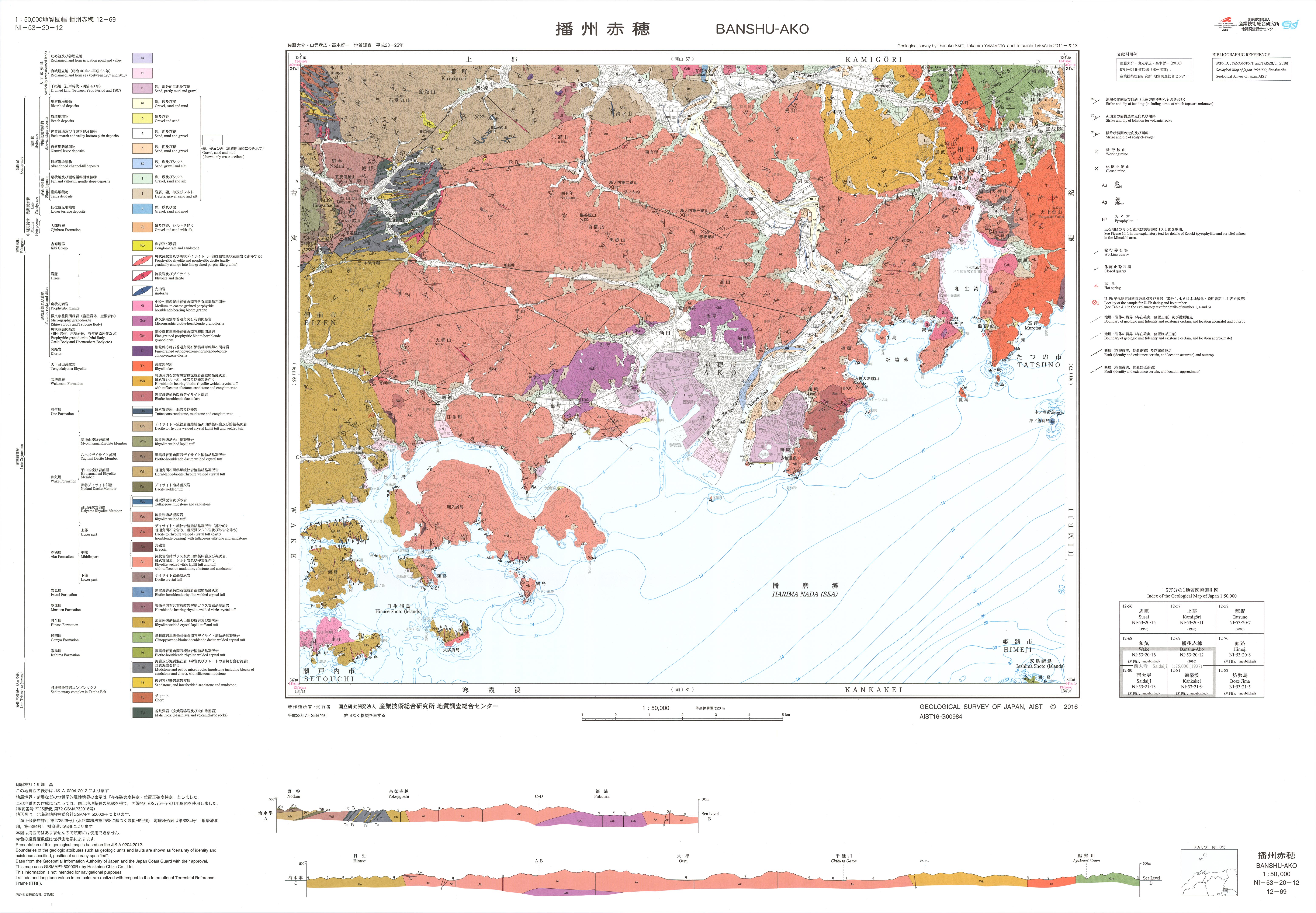
播州赤穂地域の地質: 原図
URL: https://www.gsj.jp/data/50KGM/JPG/GSJ_MAP_G050_12069_2016_200dpi.jpg
原図: ファイルサイズは 3.4 MB です。
Additional Information
| Field | Value |
|---|---|
| Resource id | 76da7125-087b-47a8-94d5-25e885ba1e8a |
| Last updated | December 7, 2023, 10:35 (+0900) |
| Created | December 7, 2023, 10:35 (+0900) |
| Format | image/jpeg |
| License | 政府標準利用規約 (第2.0版) |