-

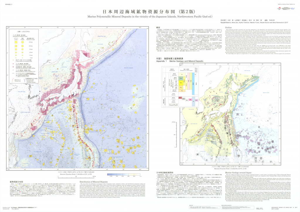
日本周辺海域鉱物資源分布図(第2版) 1:700万 (2017)
地質調査総合センター名称: 日本周辺海域鉱物資源分布図(第2版) 1:700万 / Marine Polymetallic Mineral Deposits in the Vicinity of the Japanese Islands, Northwest Pacific ( 2nd ed.) 著者: 発行年: 2017 シリーズ: 特殊地質図 /... -

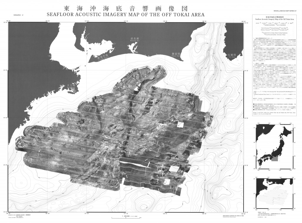
東海沖海底音響画像図,1:4,000,000 (1998)
地質調査総合センター名称: 東海沖海底音響画像図,1:4,000,000 / Seafloor Acoustic Imagery Map of the off Tokai Area, 1:4,000,000 著者: 倉本 真一, 岸本 清行, 中尾 征三, 徳山 英一, 山本 富士夫, 平 朝彦 / KURAMOTO Shin'ichi, KISHIMOTO... -

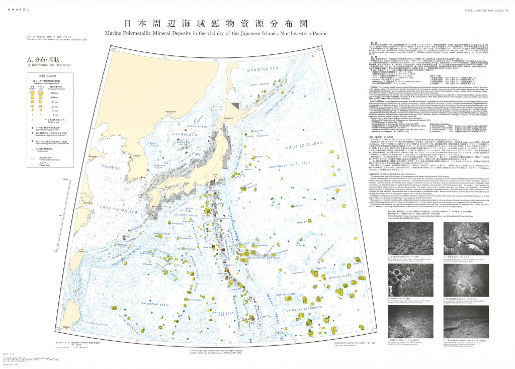
日本周辺海域鉱物資源分布図,1:7,000,000 (1994)
地質調査総合センター名称: 日本周辺海域鉱物資源分布図,1:7,000,000 / Marine Polymetallic Mineral Deposits in the Vicinity of the Japanese Island, Northwestern Pacific, 1:7,000,000 著者: 臼井 朗, 飯笹 幸吉, 棚橋 学 / USUI... -

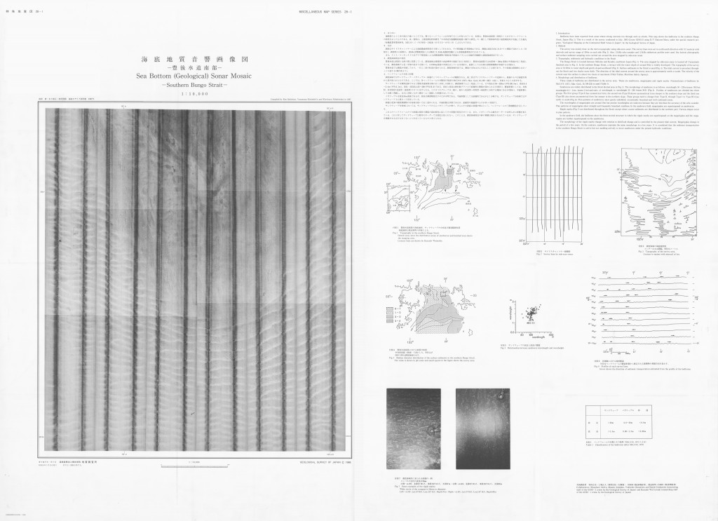
海底地質音響画像図「豊後水道南部」,1:10,000 (1988)
地質調査総合センター名称: 海底地質音響画像図「豊後水道南部」,1:10,000 / Sea Bottom (Geological) Sonar Mosaic - Southern Bungo Strait - 1:10,000 著者: 有田 正史, 上嶋 正人, 岡村 行信, 石橋 嘉一, 渡辺 和明 / ARITA Masafumi, JOSHIMA Masato,...
