-

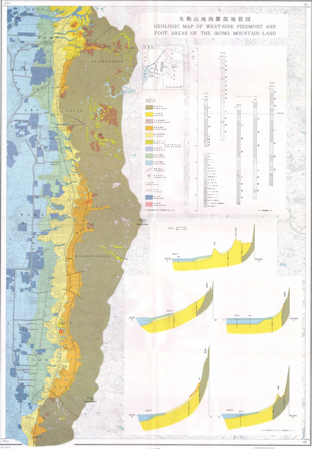
生駒山地西麓部地質図,1:25,000「生駒山地西麓の地形と地質−−山麓堆積地の地質研究の一方法−−」 (1972)
地質調査総合センター名称: 生駒山地西麓部地質図,1:25,000「生駒山地西麓の地形と地質−−山麓堆積地の地質研究の一方法−−」 / Geologic Map of West-Side Piedmont and Foot Areas of the Ikoma Mountain-Land, 1:25,000 with Explanatory Text,... -

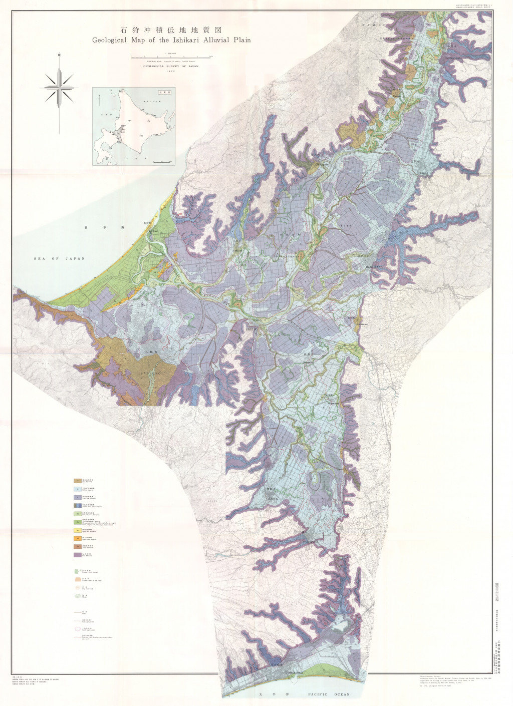
石狩沖積低地地質図,1:100,000,沖積低地の地質調査および地質図表現の新方法について--石狩平野を例として-- (1972)
地質調査総合センター名称: 石狩沖積低地地質図,1:100,000,沖積低地の地質調査および地質図表現の新方法について--石狩平野を例として-- / Geological Map of the Ishikari Alluvial Plain, 1:100,000, On the Introduction of New Methods into Surface... -

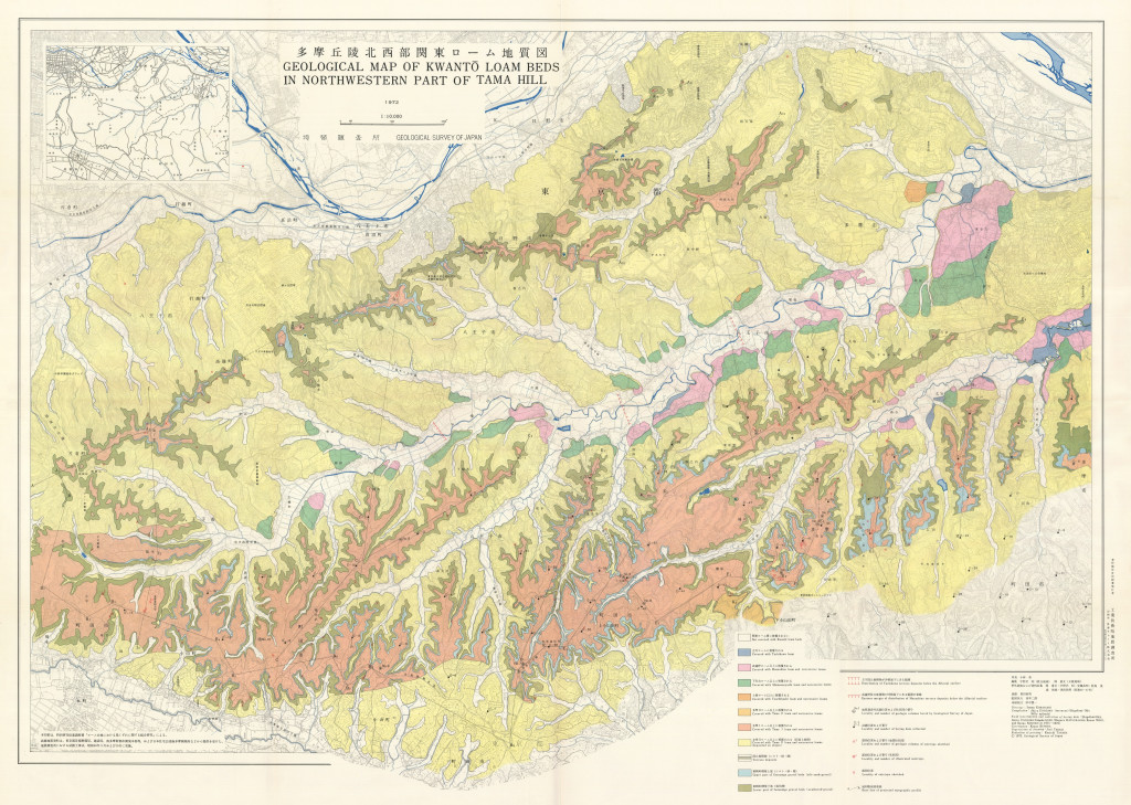
16-1 多摩丘陵北西部関東ローム地質図,1:10,000および補説 (1989)
地質調査総合センター名称: 16-1 多摩丘陵北西部関東ローム地質図,1:10,000および補説 / 16-1 Geological Map of Kwanto Loam Beds in North Western Part of Tama Hill, 1:10,000 著者: 宇野沢 昭, 岡 重文, 黒田 和男 / UNOZAWA Akira, OKA... -

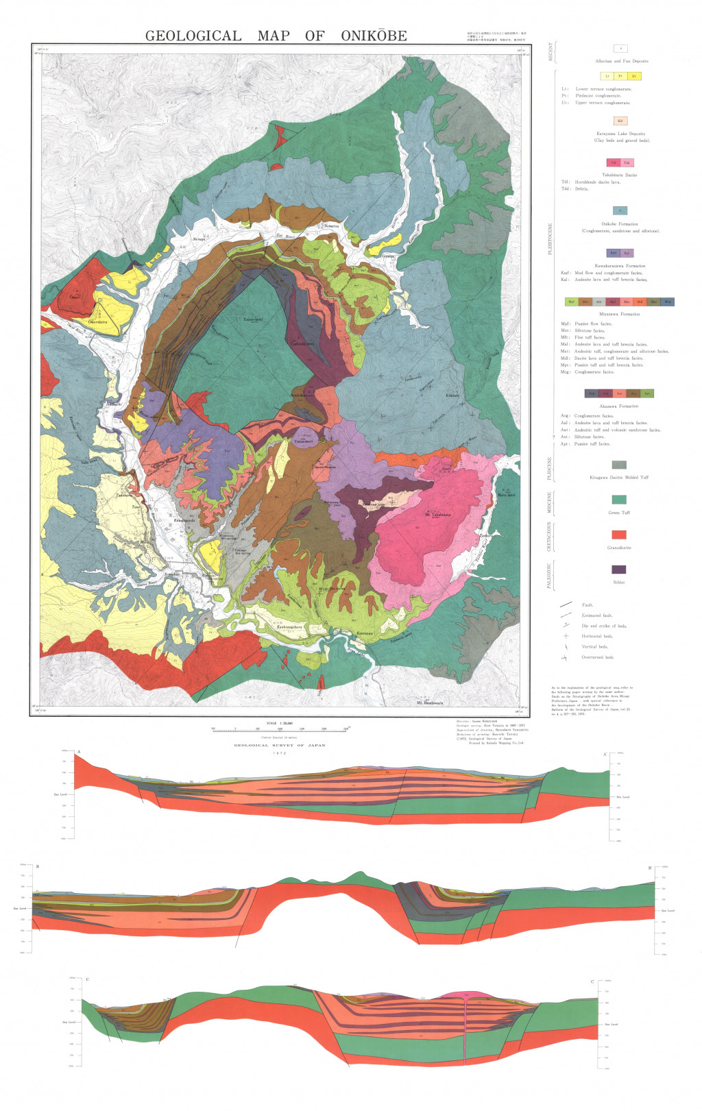
鬼首地質図,1:25,000 (1972)
地質調査総合センター名称: 鬼首地質図,1:25,000 / Geological Map of Onikobe, 1:25,000 著者: 山田 営三 / YAMADA Eizo 発行年: 1972 シリーズ: 特殊地質図 / Miscellaneous Map Series 発行者: 地質調査所 / Geological Survey of Japan マップ情報:...
