-
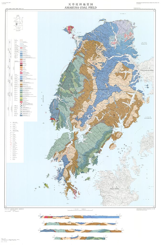
天草炭田地質図,1:50,000「熊本県天草炭田の地質及び石炭鉱床」 (1997)
地質調査総合センター名称: 天草炭田地質図,1:50,000「熊本県天草炭田の地質及び石炭鉱床」 / Geological Map of the Amakusa Coal Field, 1:50,000, and Explanatory Text 著者: 高井 保明, 坊城 俊厚, 原田 種成 / TAKAI Yasuaki, BOJO Toshiatsu, HARADA... -
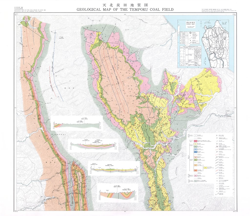
天北炭田地質図,1:25,000, 天北炭田炭層対比図ならびに地区別炭柱図 (1979)
地質調査総合センター名称: 天北炭田地質図,1:25,000, 天北炭田炭層対比図ならびに地区別炭柱図 / Geological Map of the Tempoku Coal Field, Hokkaido, Japan, 1:25,000, Correlation Chart of Coal Seams and Columnar Sections of them in... -
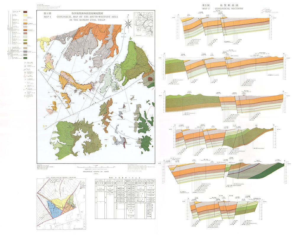
佐世保炭田西南部地域地質図,1:10,000 (1974)
地質調査総合センター名称: 佐世保炭田西南部地域地質図,1:10,000 / Geological Map of the Southwestern Area in the Sasebo Coal Field, Northern Kyushu and its Explanatory Text, 1:10,000 著者: 古川 俊太郎 / FURUAKAWA... -
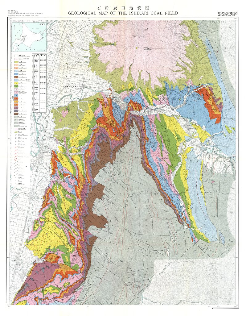
石狩炭田地質図,1:50,000および石狩炭田地質図編集について (1973)
地質調査総合センター名称: 石狩炭田地質図,1:50,000および石狩炭田地質図編集について / Geological Map of Ishikari Coal Field, 1:50,000 著者: 徳永 重元, 坊城 俊厚, 河野 迪也, 佐々木 実, 植田 芳郎, 佐藤 良昭, 井上 英二, 鈴木 泰輔, 尾上 亨, 中尾 征三, 曽我部 正敏, 根本 隆文, 佐川... -
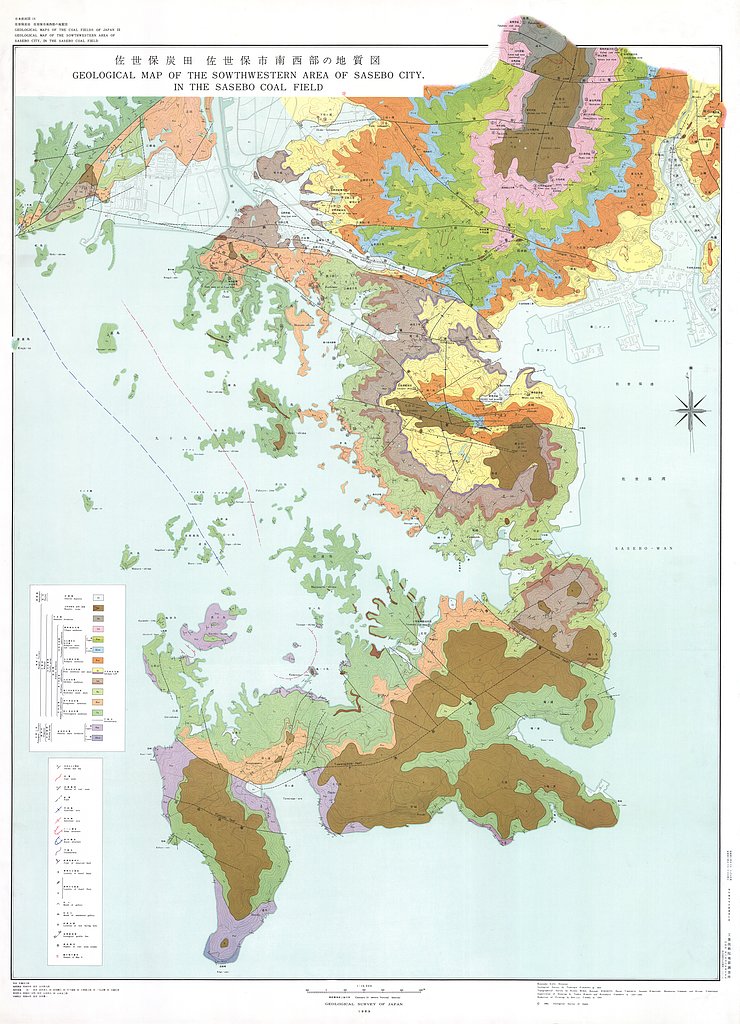
佐世保炭田佐世保市南西部地域地質図,1:10,000 (1969)
地質調査総合センター名称: 佐世保炭田佐世保市南西部地域地質図,1:10,000 / Geological Maps and Explanatory Text on the Geology and Coal Seams of the Southwestern Area of Sasebo City in the Sasebo Coal Field, Northern... -
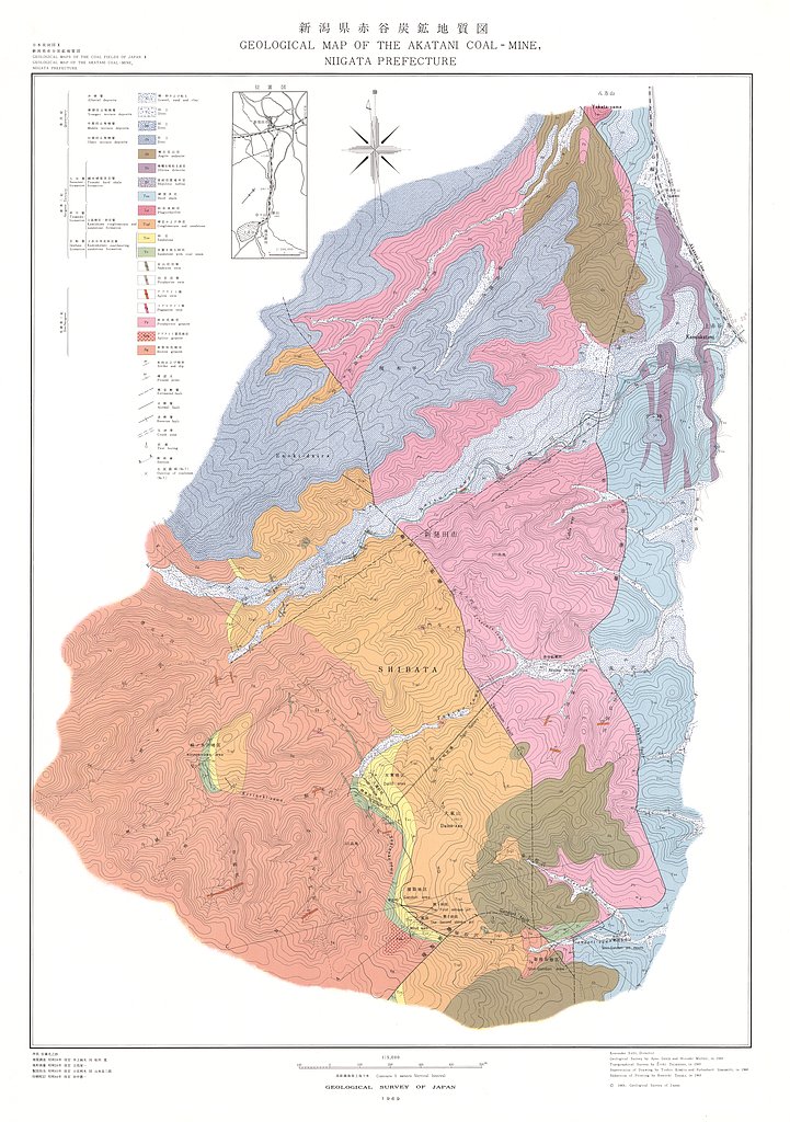
新潟県赤谷含炭地地域地質図,1:5,000 (1969)
地質調査総合センター名称: 新潟県赤谷含炭地地域地質図,1:5,000 / Geological Maps and Explanatory Text on the Geology and Coal-Seam at Akatani Coal-Mine, Niigata Prefecture,1:5,000 著者: 井上 絢夫, 松井 寛, 小松 つよし, 立花 栄一 /... -
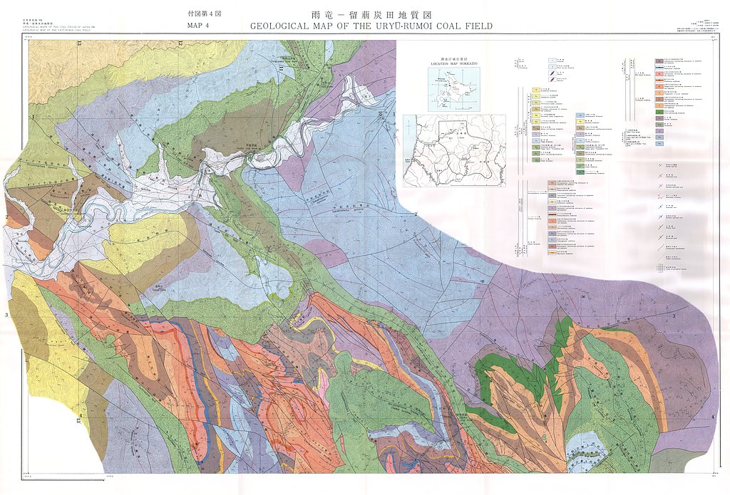
雨竜−留萌炭田地域地質図,1:20,000 (1968)
地質調査総合センター名称: 雨竜−留萌炭田地域地質図,1:20,000 / Geological Map of the Uryu-Rumoi Coal Field with Explanatory Text,1:20,000 著者: 須貝 貫二, 藤原 清丸, 福田 理, 春城 清之助, 星野 一男, 上島 宏, 河野 迪也, 久保 恭輔, 宮下 美智夫, 根本 隆文,... -
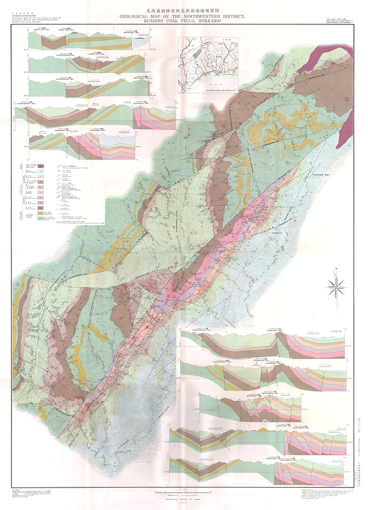
釧路炭田北西部地域地質図,1:20,000 (1967)
地質調査総合センター名称: 釧路炭田北西部地域地質図,1:20,000 / Geological Maps and Explanatory Text of the Northwestern District, Kushiro Coal Field, Hokkaido,1:20,000 著者: 曽我部 正敏, 星野 一男, 井上 英二, 鈴木 泰輔, 藤本 弁蔵, 橋本... -
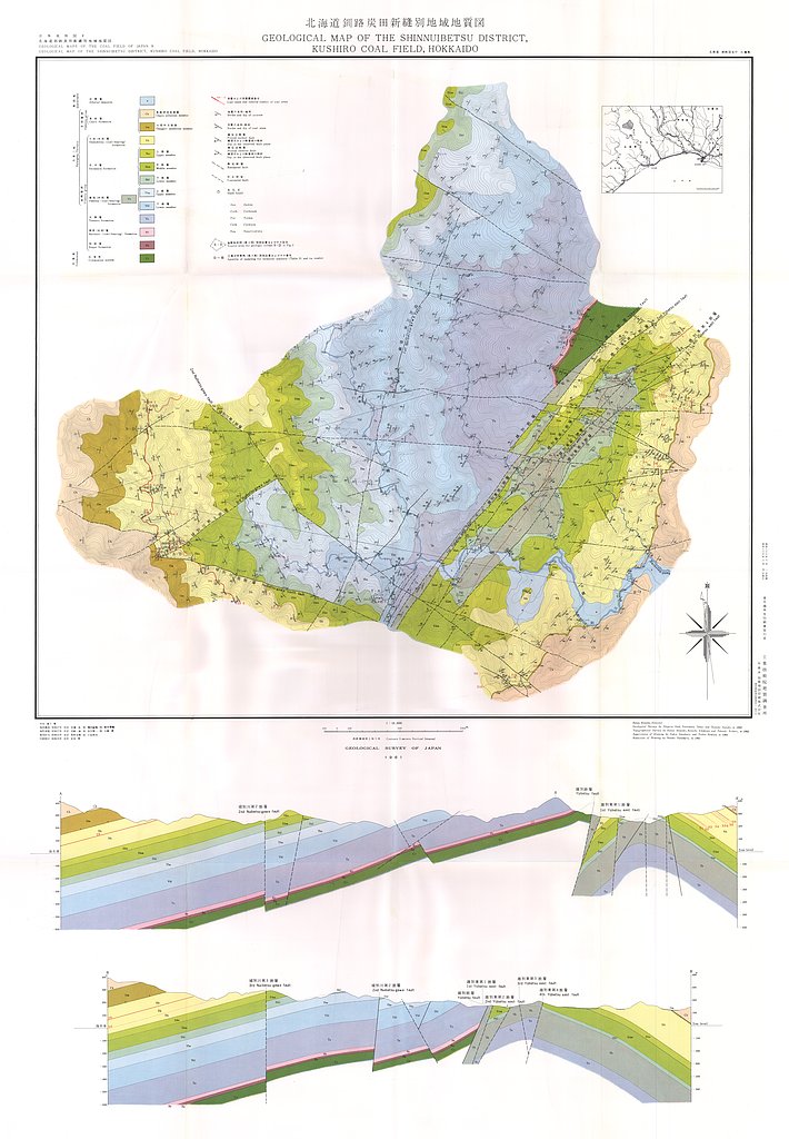
釧路炭田新縫別地域地質図,1:10,000 (1961)
地質調査総合センター名称: 釧路炭田新縫別地域地質図,1:10,000 / Geological Map and Explanatory Text of the Shinnuibetsu District, Kushiro Coal Field, Hokkaido,1:10,000 著者: 佐藤 茂, 棚井 敏雅, 鈴木 泰輔, 岩崎 一雄, 市川 賢一, 小張 孝 /... -
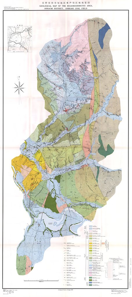
石狩炭田空知地区東芦別区域地質図,1:10,000 (1961)
地質調査総合センター名称: 石狩炭田空知地区東芦別区域地質図,1:10,000 / Geological Maps and Explanatory Text of the Higashiashibetsu Area, Sorachi District, Ishikari Coal Field,1:10,000 著者: 三田 正一, 小島 光夫, 佐々木 実, 沢田 秀穂,... -
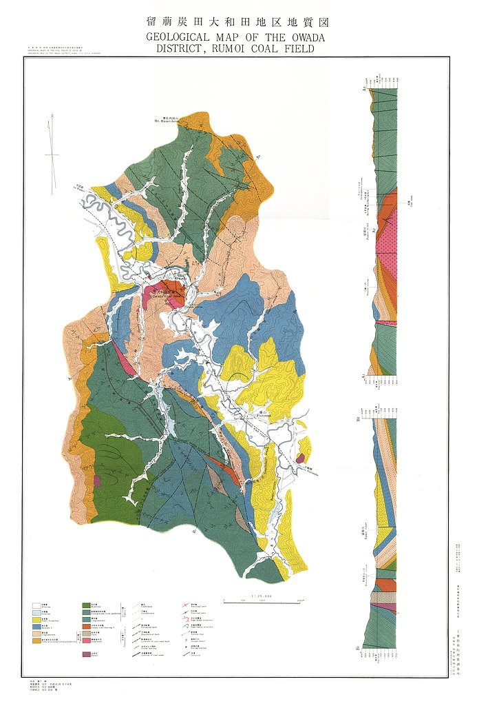
留萌炭田大和田地区地質図,1:25,000 (1959)
地質調査総合センター名称: 留萌炭田大和田地区地質図,1:25,000 / Geological Map of the Owada District, Rumoi Coal Field, Hokkaido, 1:25,000 and Explanatory Text 著者: 一杉 武治, 佐々木 実 / HITOSUGI Takeharu, SASAKI Minoru... -
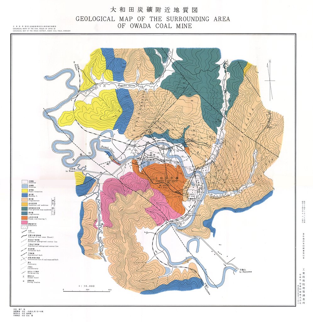
留萌炭田大和田地区地質図,1:25,000 (1959)
地質調査総合センター名称: 留萌炭田大和田地区地質図,1:25,000 / Geological Map of the Owada District, Rumoi Coal Field, Hokkaido, 1:25,000 and Explanatory Text 著者: 一杉 武治, 佐々木 実 / HITOSUGI Takeharu, SASAKI Minoru... -
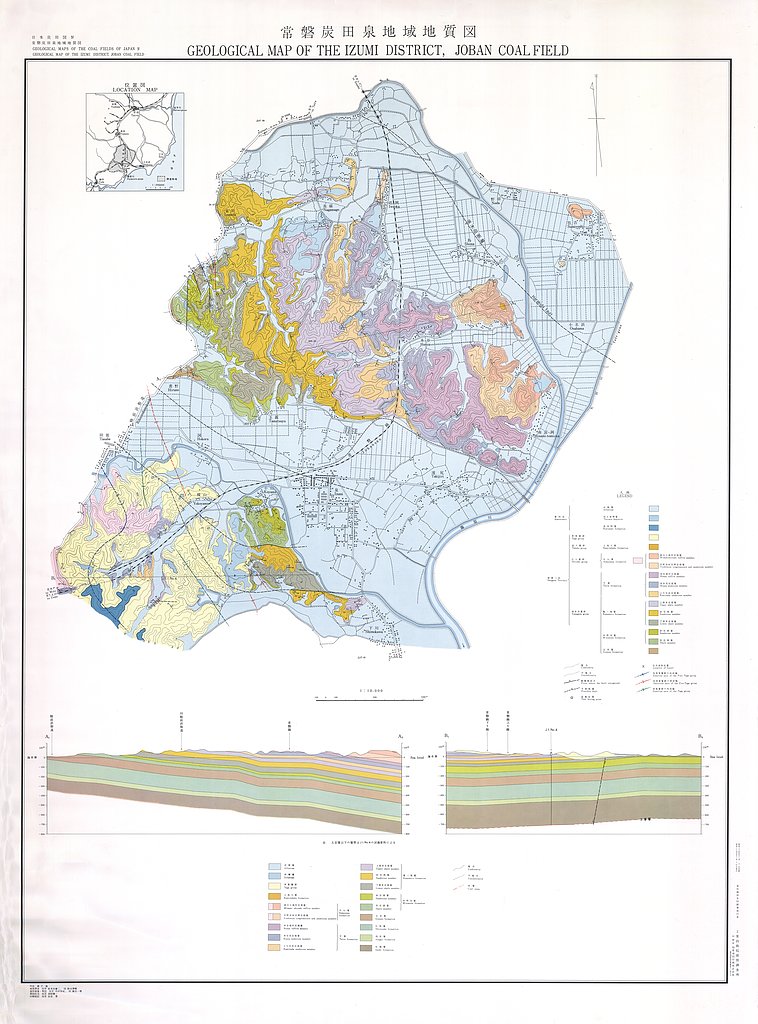
常磐炭田泉地域地質図,1:10,000 (1959)
地質調査総合センター名称: 常磐炭田泉地域地質図,1:10,000 / Geological Map of the Izumi District, Joban Coal Field, 1:10,000, and Explanatory Text 著者: 喜多河 庸二, 鈴木 泰輔 / KITAGAWA Yoji, SUZUKI Taisuke 発行年: 1959... -
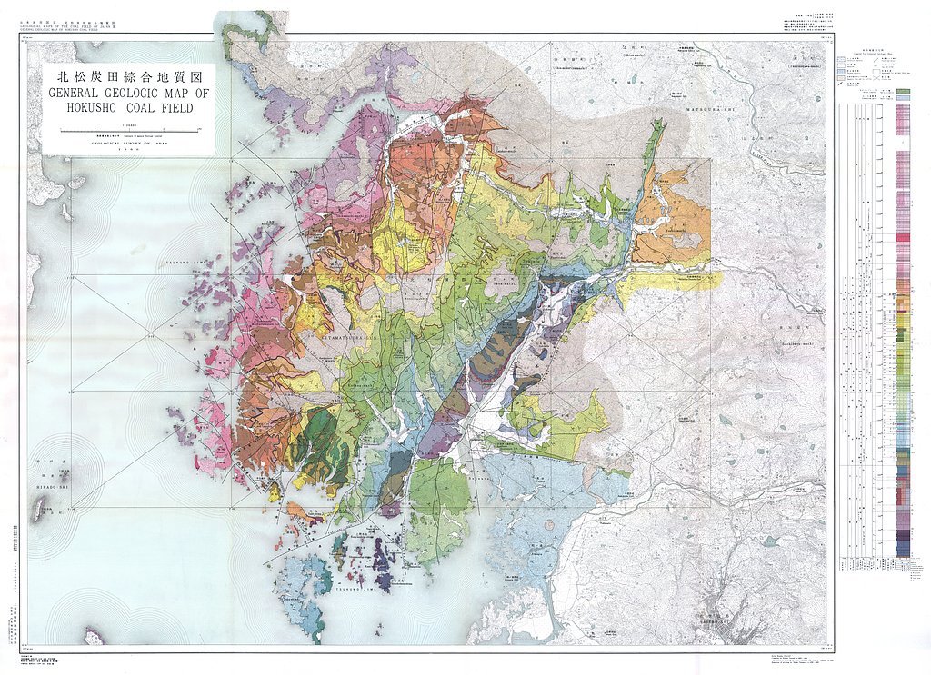
北松炭田地質図,1:10,000 (1958)
地質調査総合センター名称: 北松炭田地質図,1:10,000 / Geological Map of the Hokusho Coal Field, 1:10,000 and Explanatory Text 著者: 沢田 秀穂 / SAWATA Hideho 発行年: 1958 シリーズ: 日本炭田図 / Geological Maps of the Coal... -
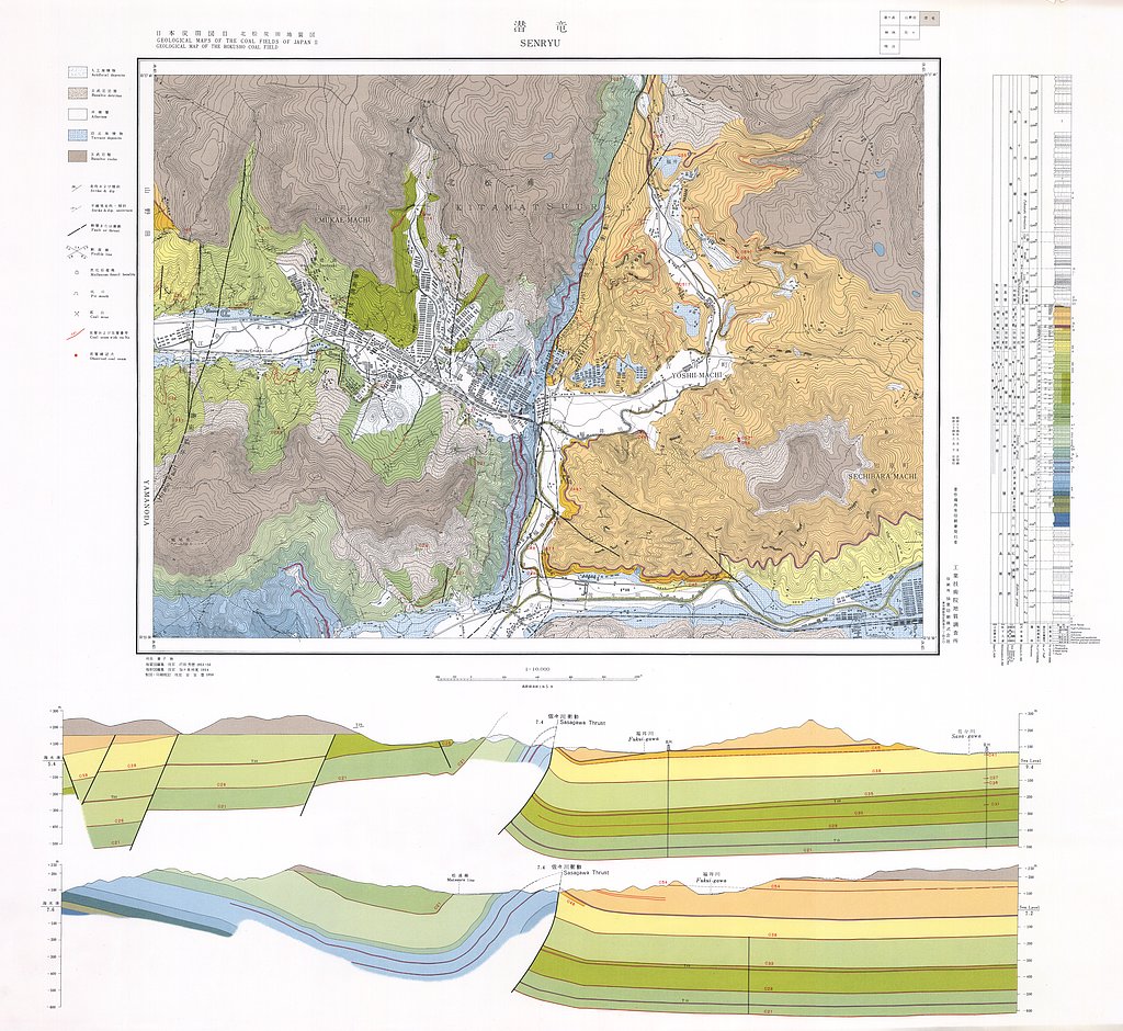
北松炭田地質図,1:10,000 (1958)
地質調査総合センター名称: 北松炭田地質図,1:10,000 / Geological Map of the Hokusho Coal Field, 1:10,000 and Explanatory Text 著者: 沢田 秀穂 / SAWATA Hideho 発行年: 1958 シリーズ: 日本炭田図 / Geological Maps of the Coal... -
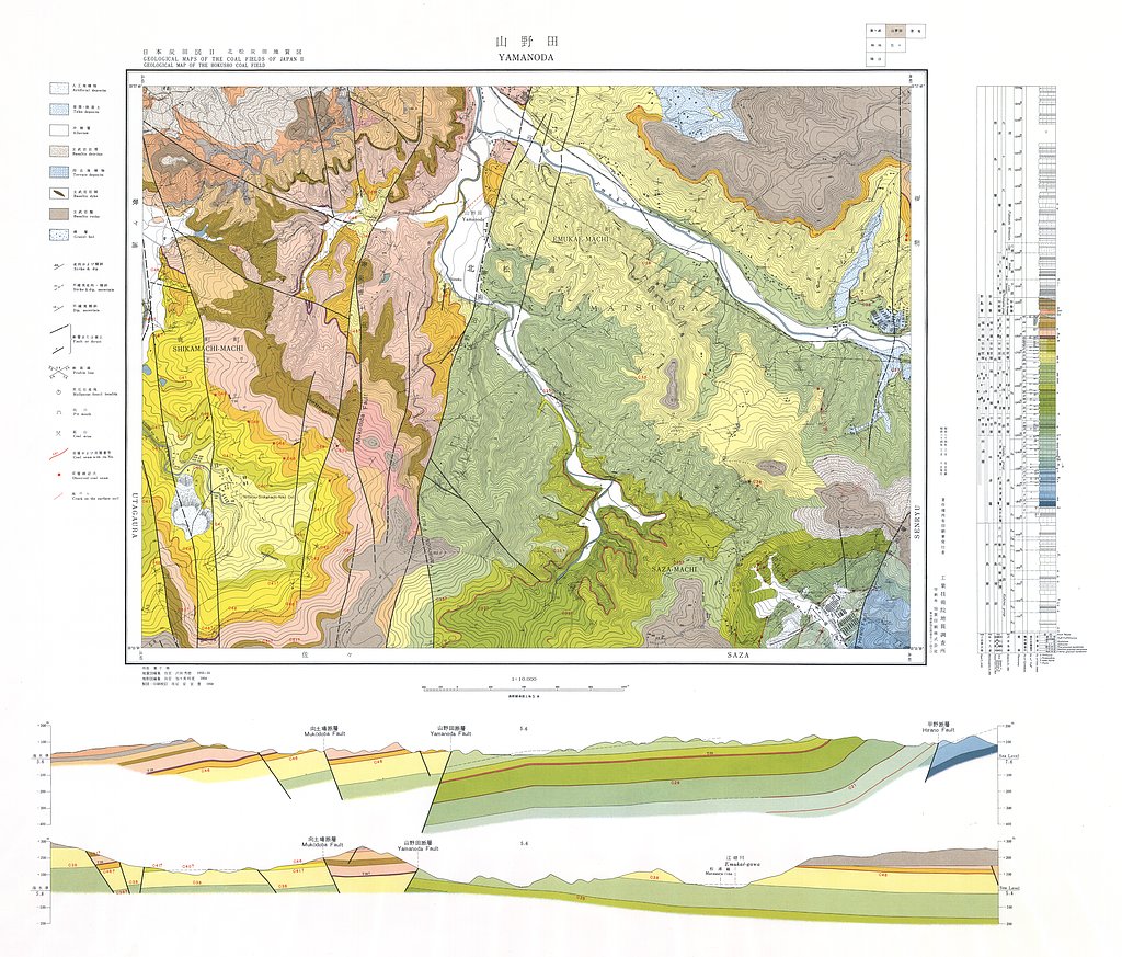
北松炭田地質図,1:10,000 (1958)
地質調査総合センター名称: 北松炭田地質図,1:10,000 / Geological Map of the Hokusho Coal Field, 1:10,000 and Explanatory Text 著者: 沢田 秀穂 / SAWATA Hideho 発行年: 1958 シリーズ: 日本炭田図 / Geological Maps of the Coal... -
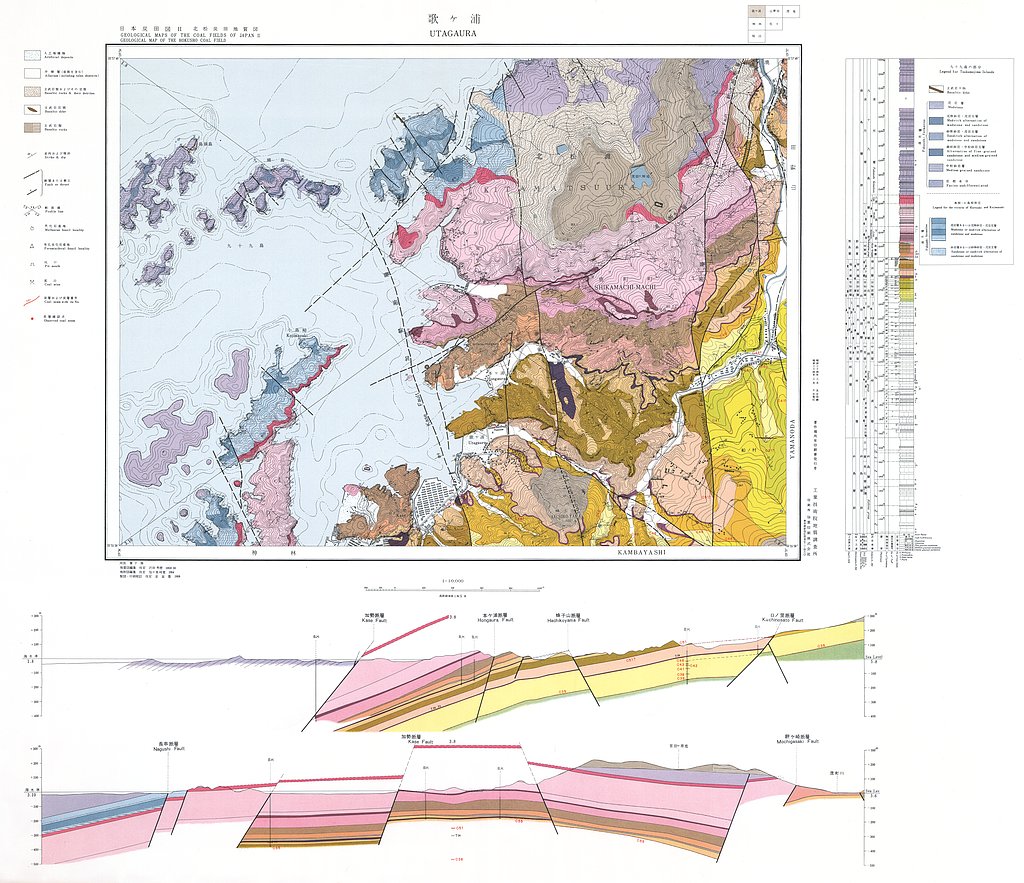
北松炭田地質図,1:10,000 (1958)
地質調査総合センター名称: 北松炭田地質図,1:10,000 / Geological Map of the Hokusho Coal Field, 1:10,000 and Explanatory Text 著者: 沢田 秀穂 / SAWATA Hideho 発行年: 1958 シリーズ: 日本炭田図 / Geological Maps of the Coal... -
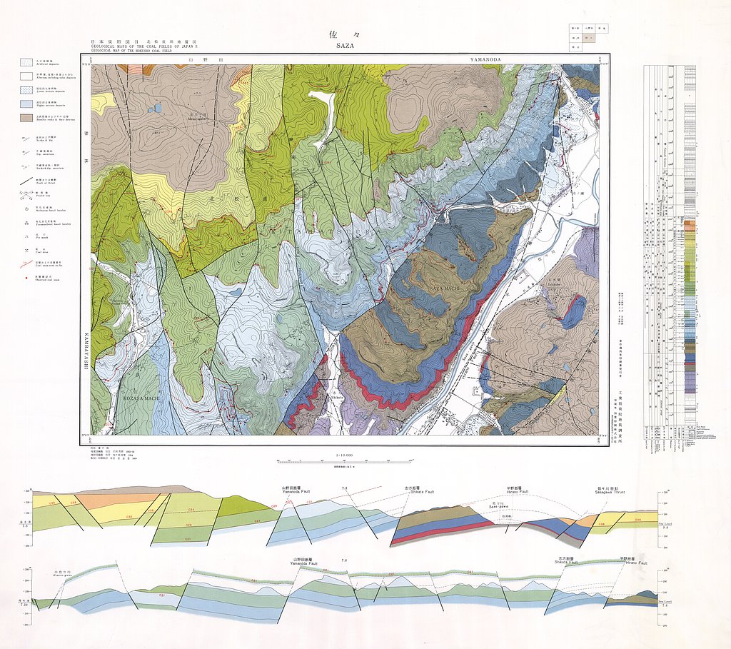
北松炭田地質図,1:10,000 (1958)
地質調査総合センター名称: 北松炭田地質図,1:10,000 / Geological Map of the Hokusho Coal Field, 1:10,000 and Explanatory Text 著者: 沢田 秀穂 / SAWATA Hideho 発行年: 1958 シリーズ: 日本炭田図 / Geological Maps of the Coal... -
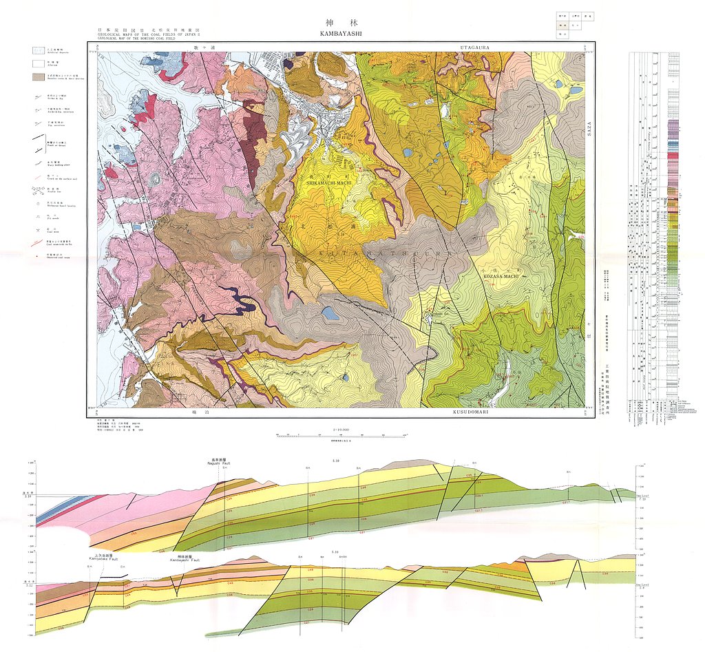
北松炭田地質図,1:10,000 (1958)
地質調査総合センター名称: 北松炭田地質図,1:10,000 / Geological Map of the Hokusho Coal Field, 1:10,000 and Explanatory Text 著者: 沢田 秀穂 / SAWATA Hideho 発行年: 1958 シリーズ: 日本炭田図 / Geological Maps of the Coal... -
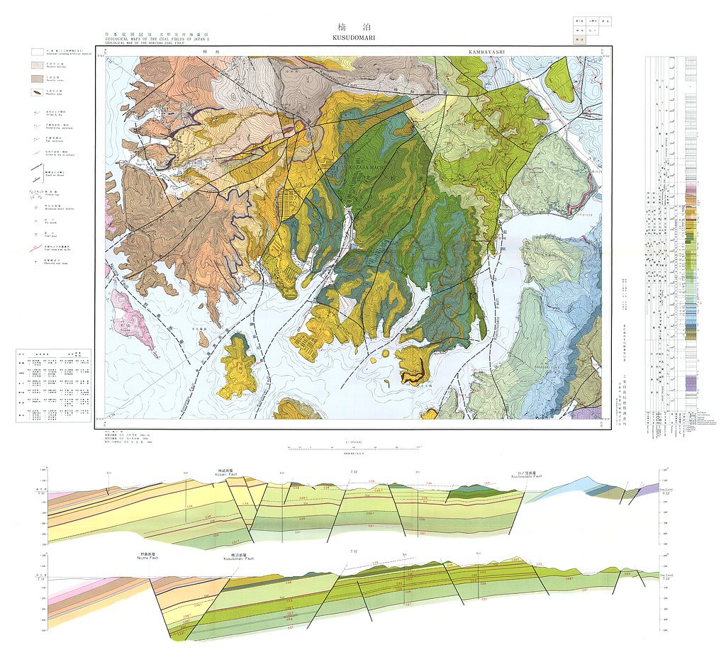
北松炭田地質図,1:10,000 (1958)
地質調査総合センター名称: 北松炭田地質図,1:10,000 / Geological Map of the Hokusho Coal Field, 1:10,000 and Explanatory Text 著者: 沢田 秀穂 / SAWATA Hideho 発行年: 1958 シリーズ: 日本炭田図 / Geological Maps of the Coal...
