-
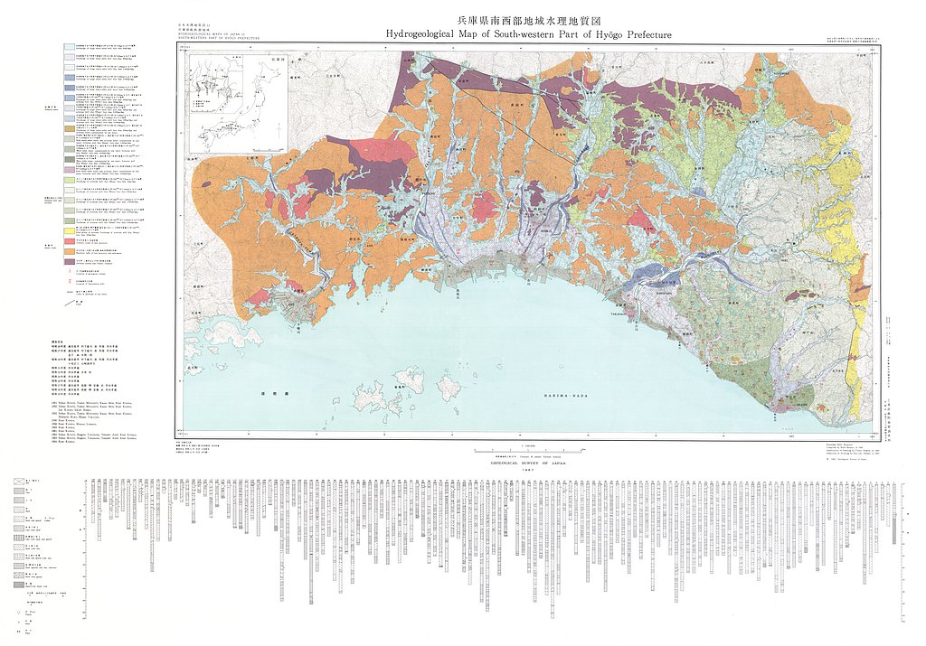
兵庫県南西部地域水理地質図,1:100,000 (1966)
地質調査総合センター名称: 兵庫県南西部地域水理地質図,1:100,000 / Hydrogeological Map and Explanatory Text of the Southwestern District of Hyogo Prefecture, 1:100,000 著者: 岸田 孝蔵 / KISHIDA Kozo 発行年: 1966 シリーズ:... -
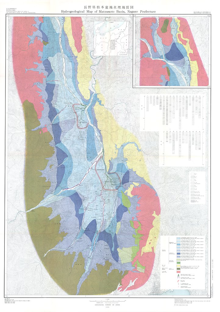
長野県松本盆地水理地質図,1:50,000 (1966)
地質調査総合センター名称: 長野県松本盆地水理地質図,1:50,000 / Hydrogeological Map and Explanatory Text of the Matsumoto Basins, 1:50,000 著者: 岸 和男, 尾崎 次男, 菅野 敏夫, 後藤 隼次 / KISHI Kazuo, OZAKI Tsugio, KANNO Toshio,... -
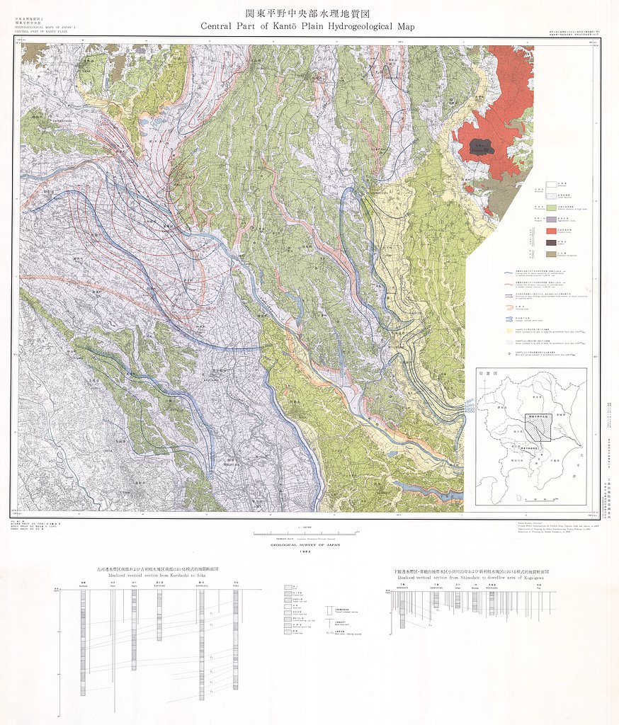
関東平野中央部水理地質図,1:100,000 (1962)
地質調査総合センター名称: 関東平野中央部水理地質図,1:100,000 / Hydrogeological Map and Explanatory Text of the Central Part of Kwanto Plain, 1:100,000 著者: 木野 義人, 安藤 武 / KINO Yoshito, ANDO Takeshi 発行年: 1962 シリーズ:... -
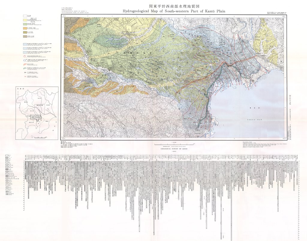
関東平野西南部水理地質図,1:100,000 (1962)
地質調査総合センター名称: 関東平野西南部水理地質図,1:100,000 / Hydrogeological Map and Explanatory Text of the Southwestern Part of Kwanto Plain, 1:100,000 著者: 森 和雄, 蔵田 延男, 小西 泰次郎, 村下 敏夫, 木野 義人, 高橋 稠, 野間 泰二, 安藤... -
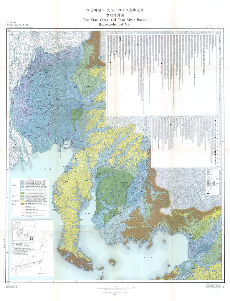
木曽川左岸・矢作川および豊川流域水理地質図,1:100,000 (1961)
地質調査総合センター名称: 木曽川左岸・矢作川および豊川流域水理地質図,1:100,000 / Hydrogeological Map and Explanatory Text of the Kiso, Yahagi and Toyo River Basins, 1:100,000 著者: 村下 敏夫, 武居 由之 / MURASHITA Toshio, TAKEI...
