-

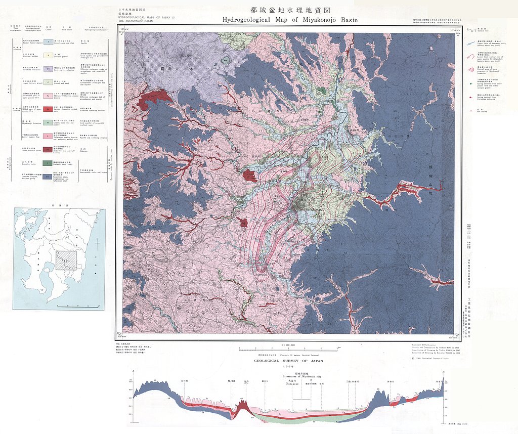
都城盆地水理地質図,1:100,000 (1968)
地質調査総合センター名称: 都城盆地水理地質図,1:100,000 / Hydrogeological Map and Explanatory Text of the Miyakonojo Basins, 1:100,000 著者: 木野 義人 / KINO Yoshito 発行年: 1968 シリーズ: 日本水理地質図 / Hydrogeological Maps of... -

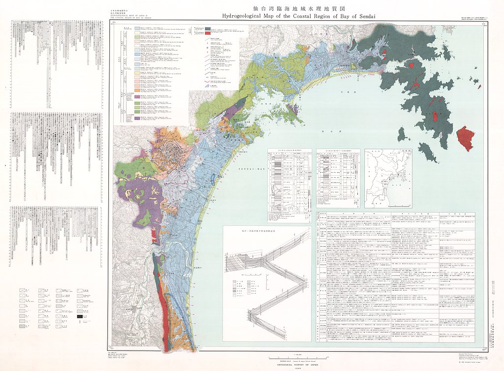
仙台湾臨海地域水理地質図,1:100,000 (1968)
地質調査総合センター名称: 仙台湾臨海地域水理地質図,1:100,000 / Hydrogeological Map of the Coastal Region of Bay of Sendai, 1:100,000 著者: 奥津 春生 / OKUTSU Haruo 発行年: 1968 シリーズ: 日本水理地質図 / Hydrogeological Maps of... -

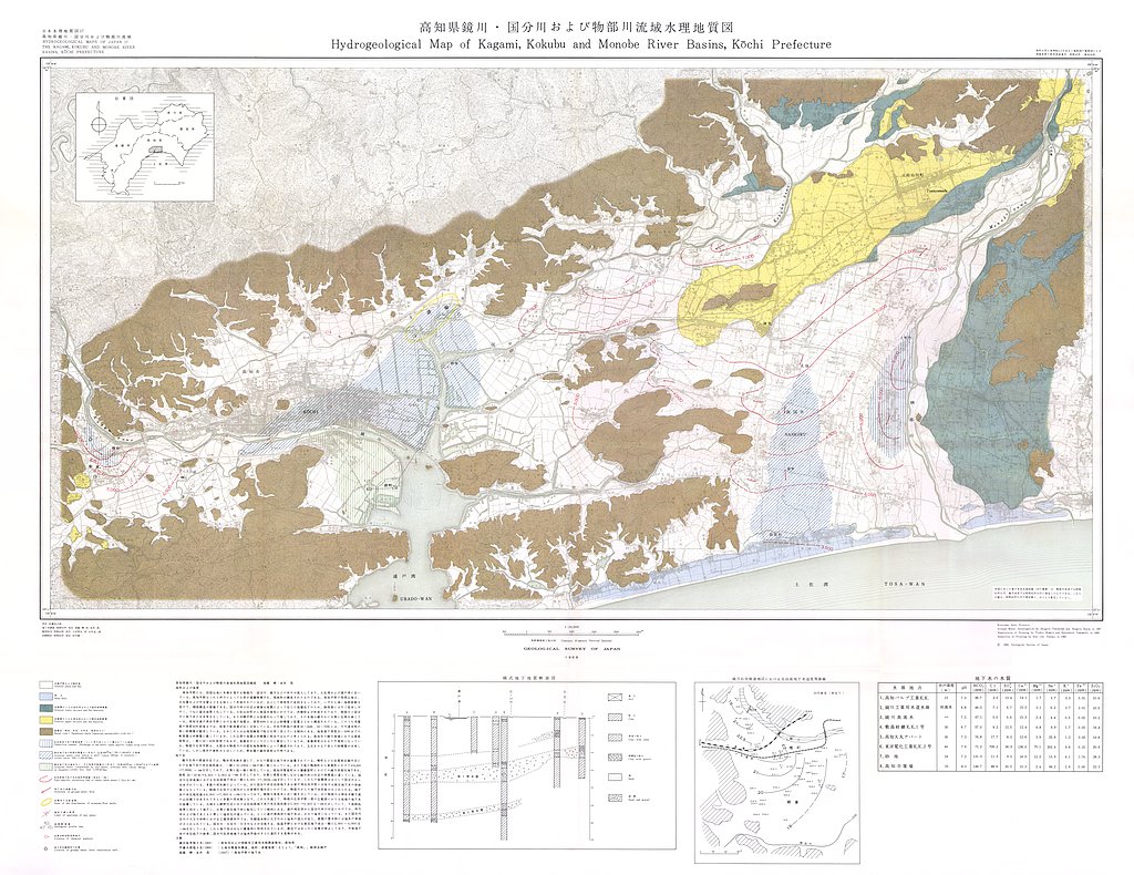
高知県鏡川・国分川および物部川流域水理地質図,1:25,000 (1968)
地質調査総合センター名称: 高知県鏡川・国分川および物部川流域水理地質図,1:25,000 / Hydrogeological Map of Kagami, Kokubu and Monobe River Basins, Kochi Prefecture, 1:25,000 著者: 高橋 稠, 永井 茂 / TAKAHASHI Shigeru, NAGAI Shigeru...
