-
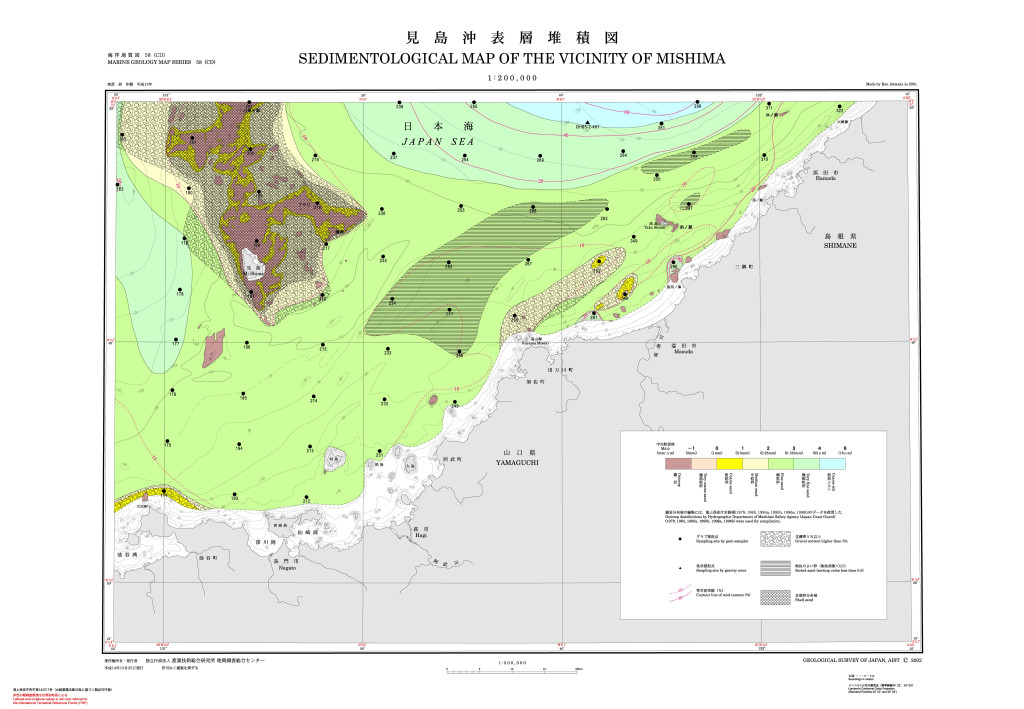
見島沖表層堆積図 1:200,000 (2002)
地質調査総合センター名称: 見島沖表層堆積図 1:200,000 / Sedimentological Map of the Vicinity of Mishima and Explanatory Notes 1:200,000 著者: 池原 研 / IKEHARA Ken 発行年: 2002 シリーズ: 海洋地質図 / Marine Geology Map Series... -
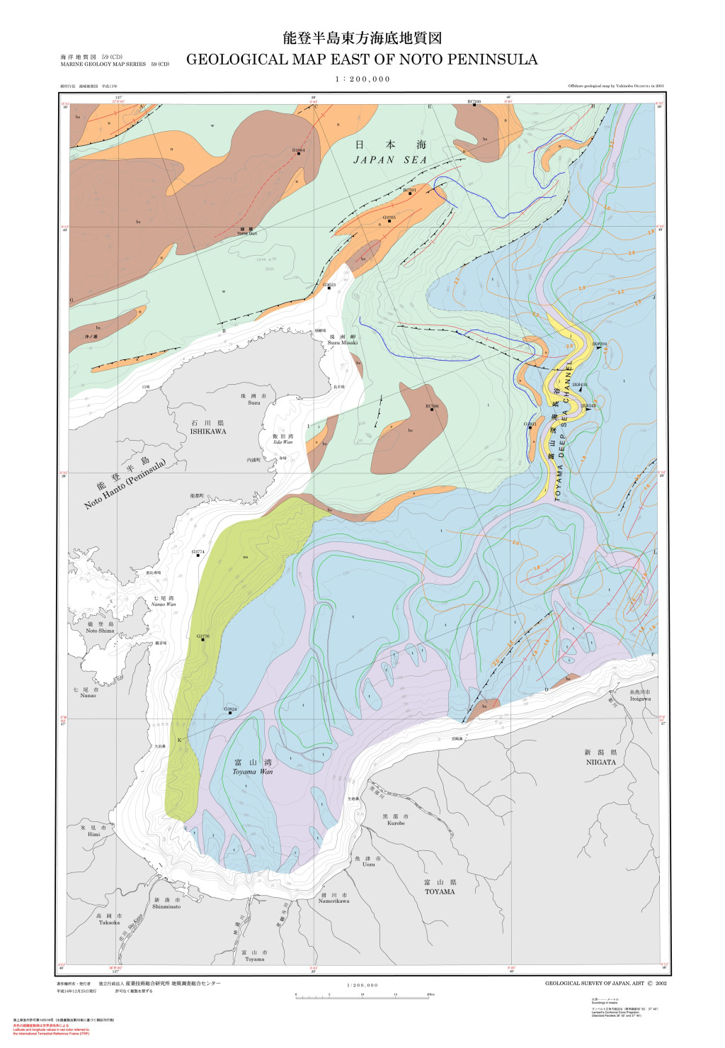
能登半島東方海底地質図 1:200,000 (2002)
地質調査総合センター名称: 能登半島東方海底地質図 1:200,000 / Geological Map East of Noto Peninsula and Explanatory Notes 1:200,000 著者: 岡村 行信 / OKAMURA Yukinobu 発行年: 2002 シリーズ: 海洋地質図 / Marine Geology Map Series... -
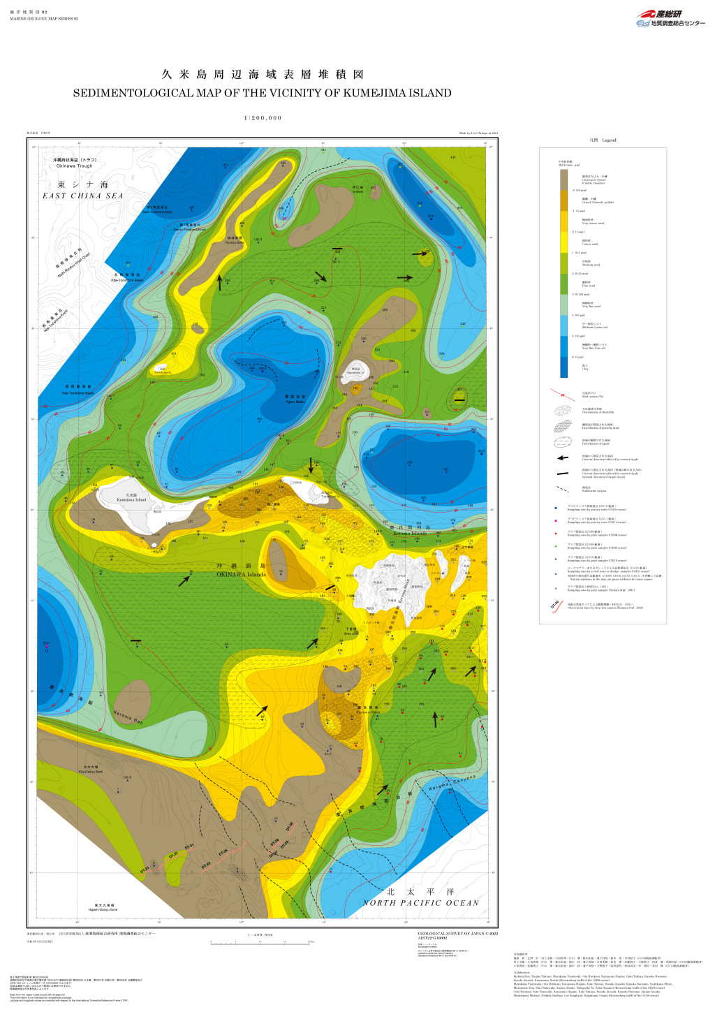
久米島周辺海域表層堆積図 (2022)
地質調査総合センター名称: 久米島周辺海域表層堆積図 / Vicinity of Kumejima Island 著者: 発行年: 2022 シリーズ: 海洋・表層堆積図20万 / 1:200K Sedimentological Map 発行者: マップ情報:... -
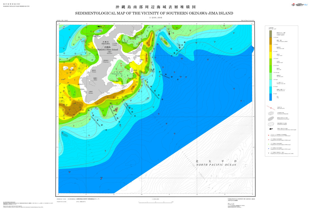
沖縄島南部周辺海域海洋地質図 1:200,000 (2018)
地質調査総合センター名称: 沖縄島南部周辺海域海洋地質図 1:200,000 / Marine Geology Map of the Vicinity of Southern Okinawa-jima Island 1:200,000 著者: 荒井 晃作, 井上 卓彦, 佐藤 智之, 小田 啓邦, 板木 拓也 / ARAI Kohsaku, INOUE Takahiko,... -
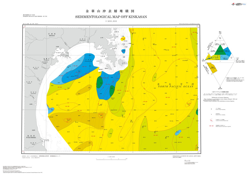
金華山沖表層堆積図 1:200,000 (2016)
地質調査総合センター名称: 金華山沖表層堆積図 1:200,000 / Sedimentological Map Off Kinkasan 1:200,000 著者: 西村 昭, 齋藤 文紀 / NISHIMURA Akira, SAITO Yoshiki 発行年: 2016 シリーズ: 海洋地質図 / Marine Geology Map Series 発行者:... -
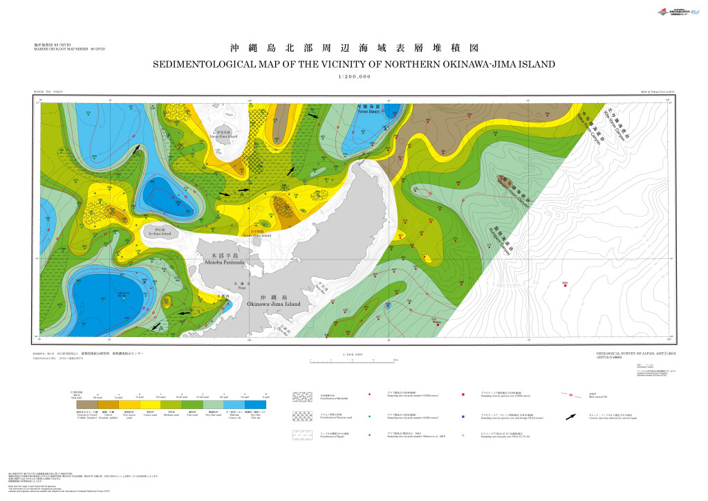
沖縄島北部周辺海域海洋地質図 1:200,000 (2015)
地質調査総合センター名称: 沖縄島北部周辺海域海洋地質図 1:200,000 / Marine Geology Map of the Vicinity of Northern Okinawa-jima Island 1:200,000 著者: 荒井 晃作, 佐藤 智之, 井上 卓彦 / ARAI Kohsaku, SATO Tomoyuki, INOUE Takahiko... -
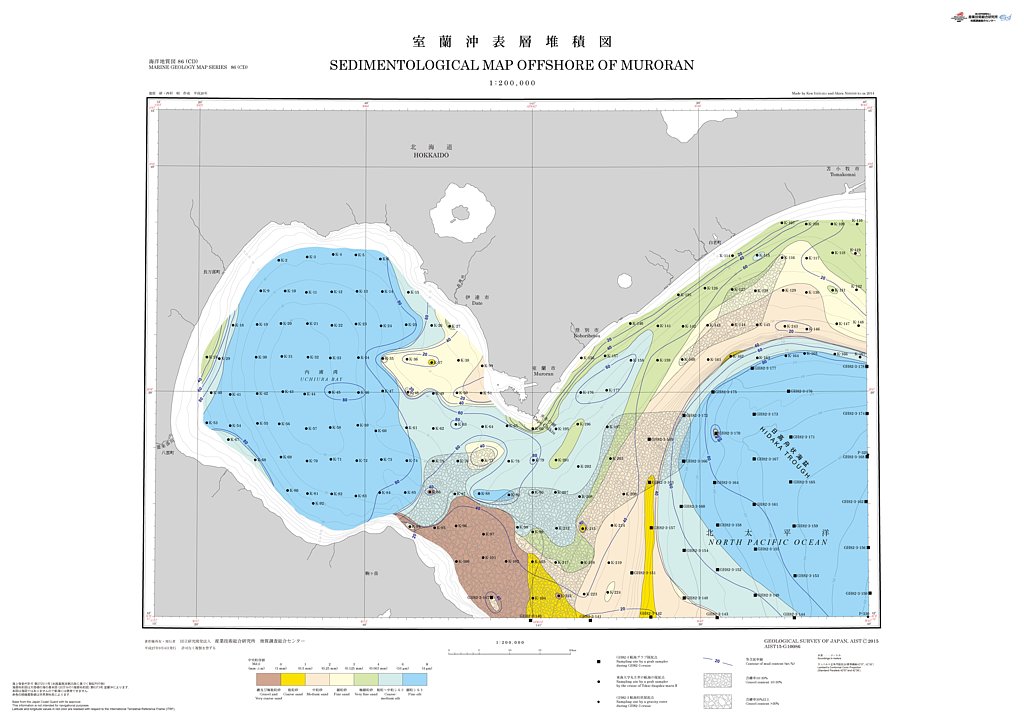
室蘭沖表層堆積図 1:200,000 (2015)
地質調査総合センター名称: 室蘭沖表層堆積図 1:200,000 / Sedimentological Map Offshore of Muroran 1:200,000 著者: 池原 研, 西村 昭 / IKEHARA Ken, NISHIMURA Akira 発行年: 2015 シリーズ: 海洋地質図 / Marine Geology Map Series 発行者:... -
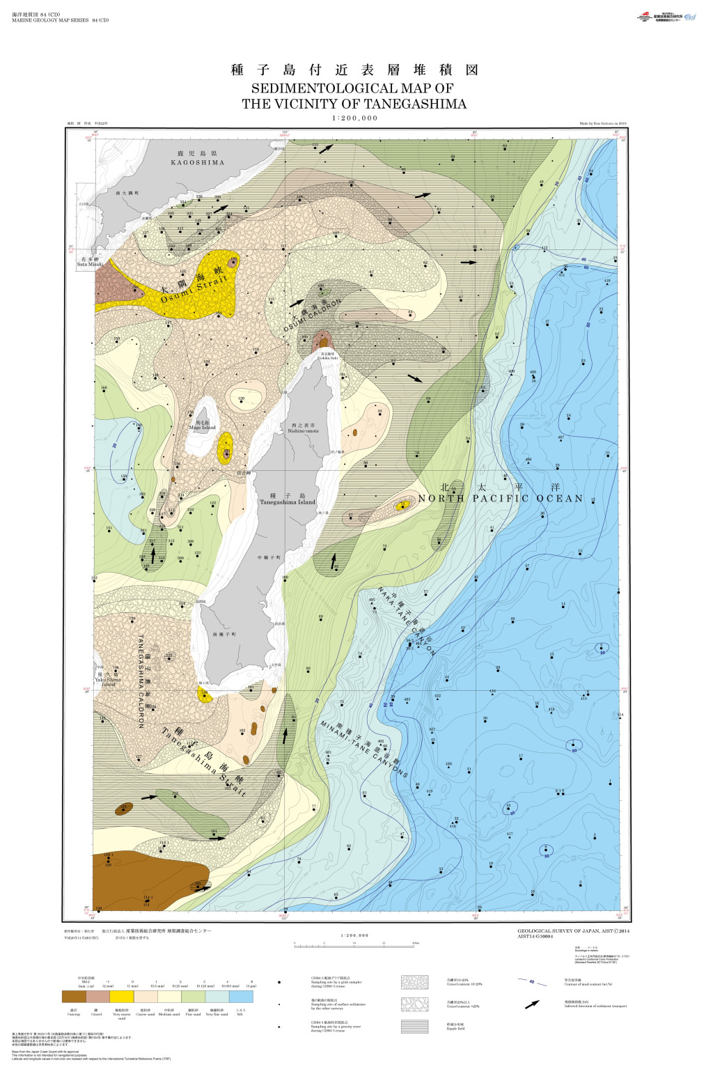
種子島付近表層堆積図 1:200,000 (2014)
地質調査総合センター名称: 種子島付近表層堆積図 1:200,000 / Sedimentological Map of the Vicinity of Tanegashima, 1:200,000 著者: 池原 研 / IKEHARA Ken 発行年: 2014 シリーズ: 海洋地質図 / Marine Geology Map Series 発行者:... -
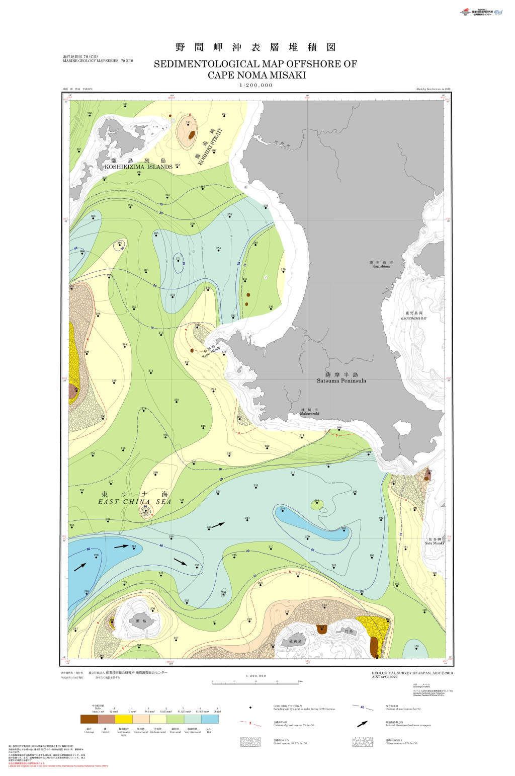
野間岬沖表層堆積図 1:200,000 (2013)
地質調査総合センター名称: 野間岬沖表層堆積図 1:200,000 / Sedimentological Map Offshore of Cape Noma Misaki 1:200,000 著者: 池原 研 / IKEHARA Ken 発行年: 2013 シリーズ: 海洋地質図 / Marine Geology Map Series 発行者:... -
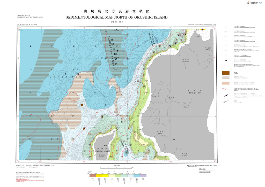
奥尻島北方表層堆積図 1:200,000 (2013)
地質調査総合センター名称: 奥尻島北方表層堆積図 1:200,000 / Sedimentological Map North of Okushiri Island, 1:200,000 著者: 片山 肇, 井内 美郎, 池原 研 / KATAYAMA Hajime, INOUCHI Yoshio, IKEHARA Ken 発行年: 2013 シリーズ: 海洋地質図 /... -
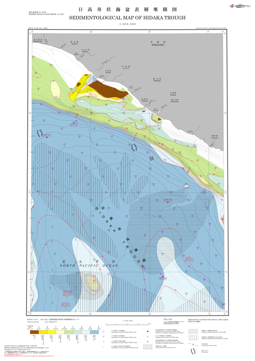
日高舟状海盆表層堆積図 1:200,000 (2013)
地質調査総合センター名称: 日高舟状海盆表層堆積図 1:200,000 / Sedimentological Map of Hidaka Trough, 1:200,000 著者: 野田 篤, 片山 肇 / NODA Atsushi, KATAYAMA Hajime 発行年: 2013 シリーズ: 海洋地質図 / Marine Geology Map Series... -
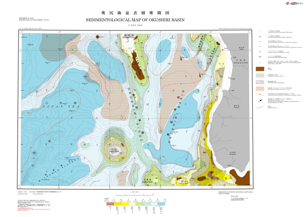
奥尻海盆表層堆積図1:200,000 (2013)
地質調査総合センター名称: 奥尻海盆表層堆積図1:200,000 / Sedimentological Map of Okushiri Basin, 1:200,000 著者: 片山 肇, 井内 美郎, 池原 研 / KATAYAMA Hajime, INOUCHI Yoshio, IKEHARA Ken 発行年: 2013 シリーズ: 海洋地質図 / Marine... -
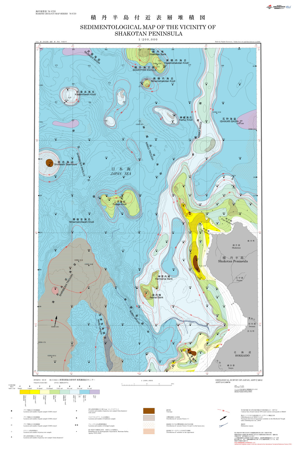
積丹半島付近表層堆積図 1:200,000 (2012)
地質調査総合センター名称: 積丹半島付近表層堆積図 1:200,000 / Sedimentological Map of the Vicinity of Shakotan Peninsula and Explanatory Notes 1:200,000 著者: 片山 肇, 井内 美郎, 池原 研 / KATAYAMA Hajime, INOUCHI Yoshio,... -
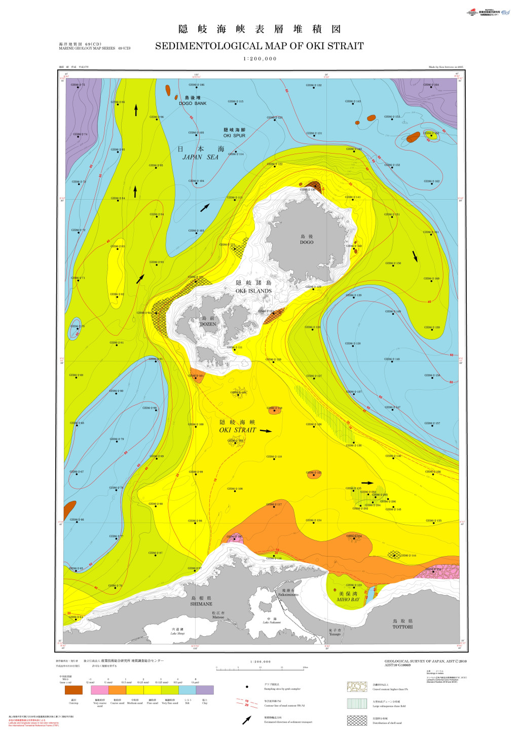
隠岐海峡表層堆積図 1:200,000 (2010)
地質調査総合センター名称: 隠岐海峡表層堆積図 1:200,000 / Sedimentological Map of Oki Strait and Explanatory Notes 1:200,000 著者: 池原 研 / IKEHARA Ken 発行年: 2010 シリーズ: 海洋地質図 / Marine Geology Map Series 発行者:... -
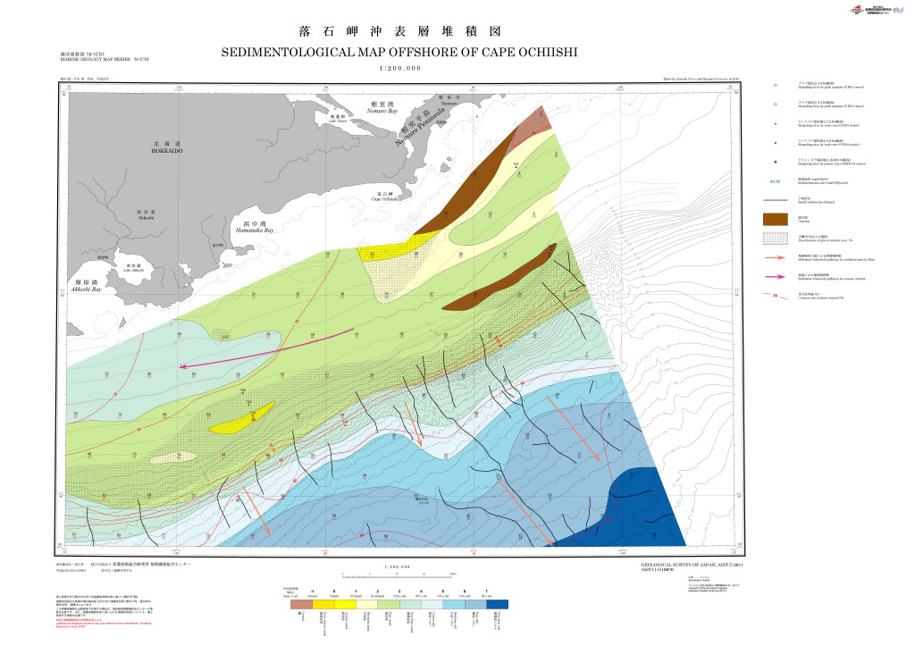
落石岬沖表層堆積図 1:200,000 (2011)
地質調査総合センター名称: 落石岬沖表層堆積図 1:200,000 / Sedimentological Map Offshore of Cape Ochiishi and Explanatory Notes 1:200,000 著者: 野田 篤, 片山 肇 / NODA Atsushi, KATAYAMA Hajime 発行年: 2011 シリーズ: 海洋地質図 /... -
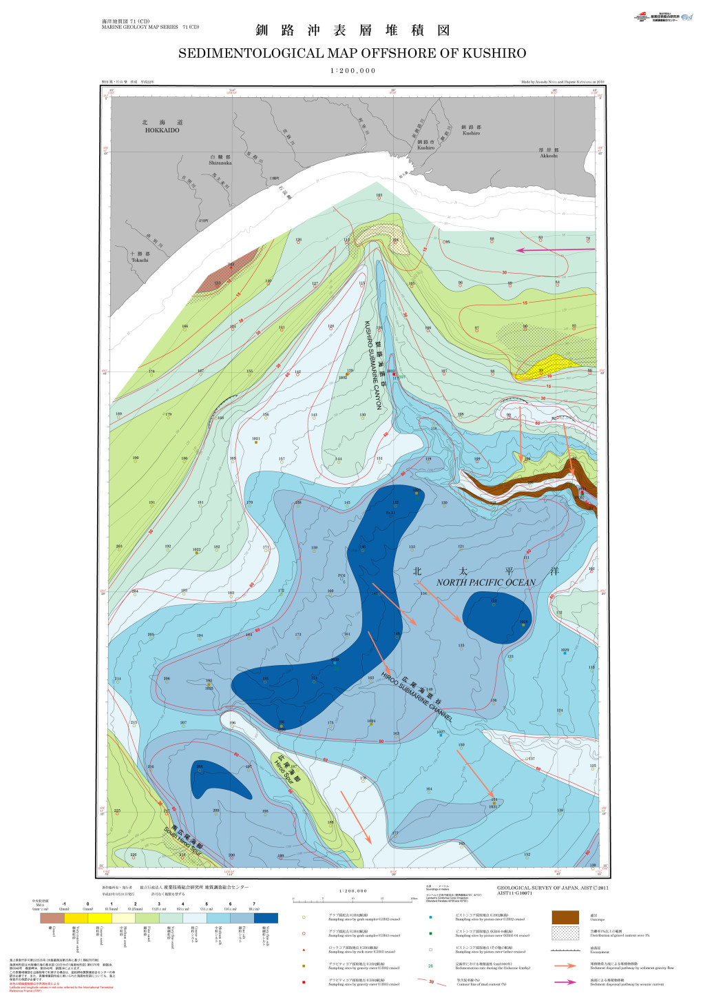
釧路沖表層地質図 1:200,000 (2011)
地質調査総合センター名称: 釧路沖表層地質図 1:200,000 / Sedimentological Map Offshore of Kushiro and Explanatory Notes 1:200,000 著者: 野田 篤, 片山 肇 / NODA Atsushi, KATAYAMA Hajime 発行年: 2011 シリーズ: 海洋地質図 / Marine... -
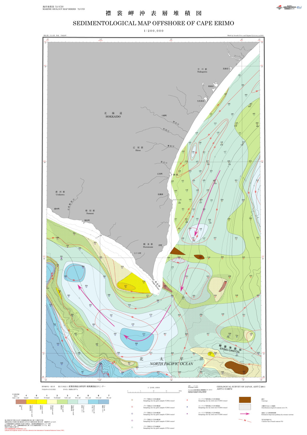
襟裳岬沖表層堆積図 1:200,000 (2011)
地質調査総合センター名称: 襟裳岬沖表層堆積図 1:200,000 / Sedimentological Map Offshore of Cape Erimo and Explanatory Notes 1:200,000 著者: 野田 篤, 片山 肇 / NODA Atsushi, KATAYAMA Hajime 発行年: 2011 シリーズ: 海洋地質図 /... -
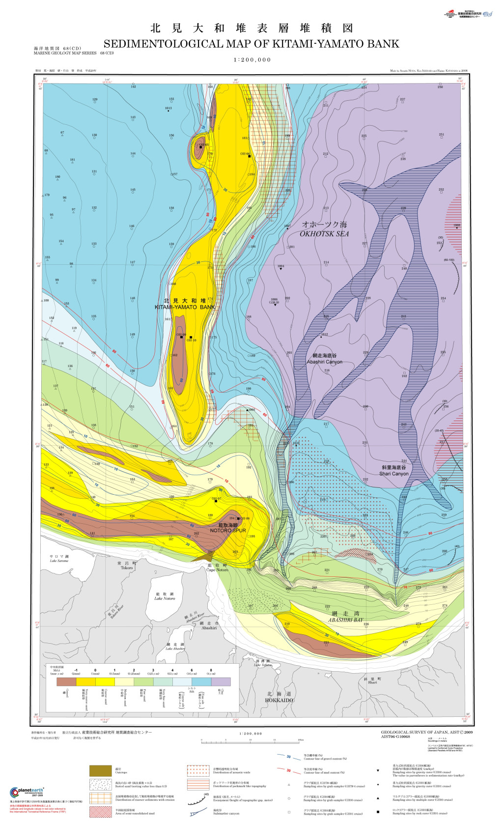
北見大和堆表層堆積図 1:200,000 (2009)
地質調査総合センター名称: 北見大和堆表層堆積図 1:200,000 / Sedimentological Map of Kitami-Yamato Bank and Explanatory Notes 1:200,000 著者: 野田 篤, 池原 研, 片山 肇 / NODA Atsushi, IKEHARA Ken, KATAYAMA Hajime 発行年: 2009... -
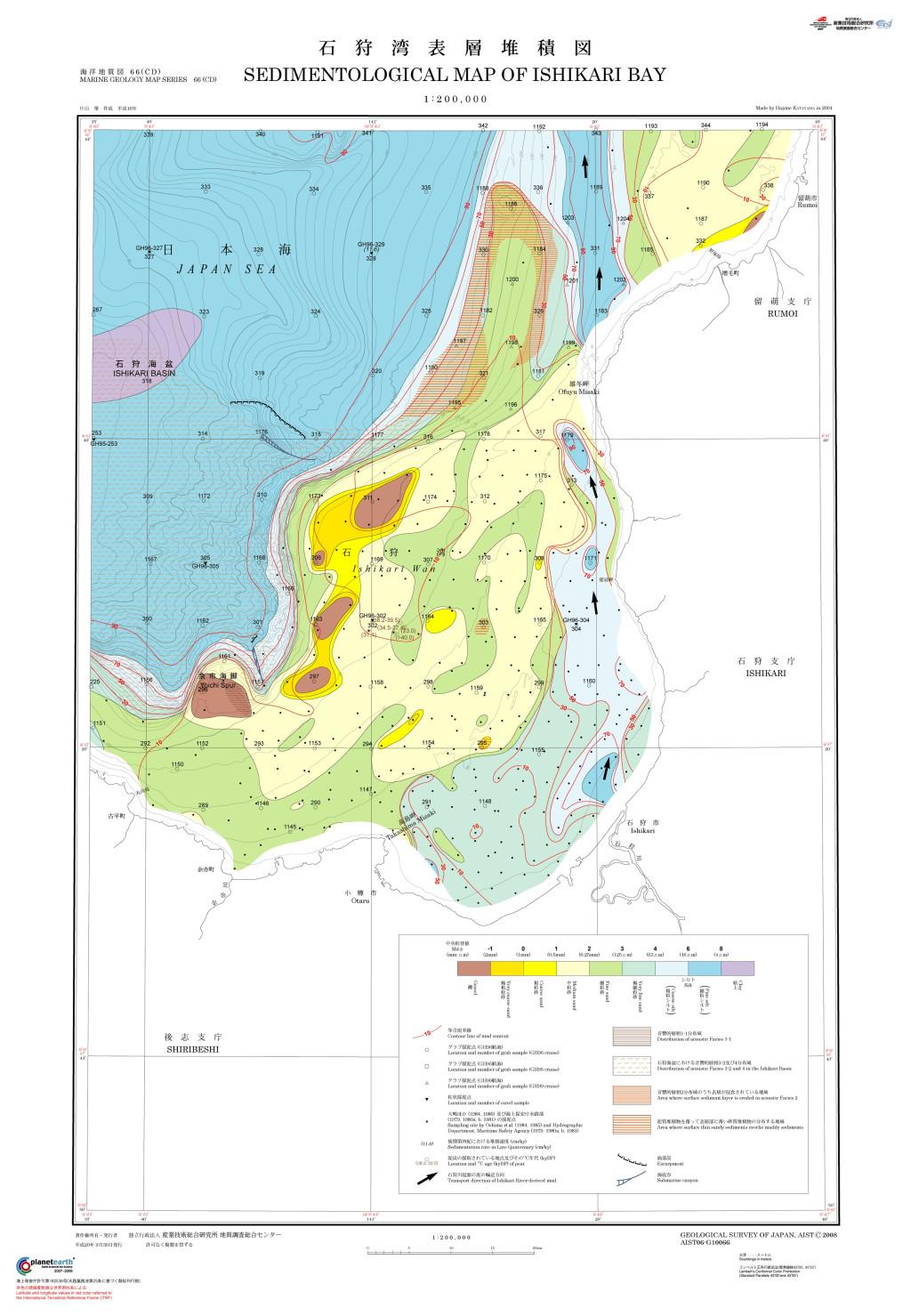
石狩湾表層堆積図 1:200,000 (2008)
地質調査総合センター名称: 石狩湾表層堆積図 1:200,000 / Sedimentological Map of Ishikari Bay and Explanatory Notes 1:200,000 著者: 片山 肇 / KATAYAMA Hajime 発行年: 2008 シリーズ: 海洋地質図 / Marine Geology Map Series 発行者:... -
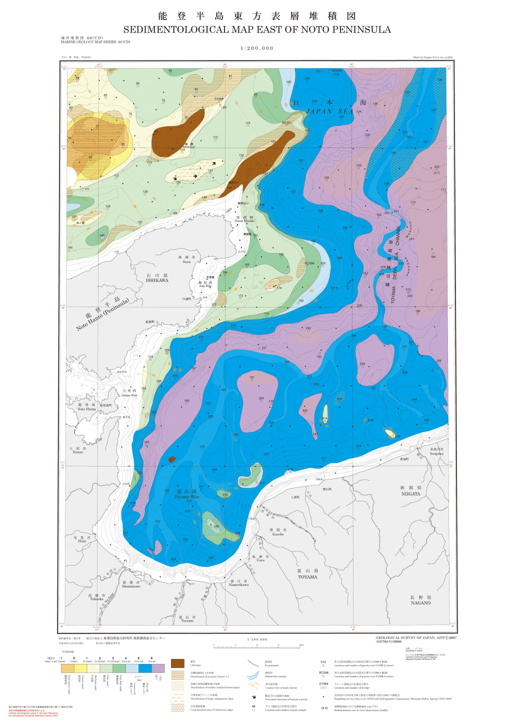
能登半島東方表層堆積図 1:200,000 (2007)
地質調査総合センター名称: 能登半島東方表層堆積図 1:200,000 / Sedimentological Map East of Noto Peninsula and Explanatory Notes 1:200,000 著者: 片山 肇 / KATAYAMA Hajime 発行年: 2007 シリーズ: 海洋地質図 / Marine Geology Map...
